Lovecraft on Martin Vargic’s new Map of the Literature II.


01 Friday Nov 2019
Posted in Maps, Odd scratchings
Lovecraft on Martin Vargic’s new Map of the Literature II.
17 Tuesday Sep 2019
Posted in Historical context, Lovecraftian arts, Maps, Odd scratchings
It strikes me that there are now enough pictures of College Street to be able to recreate this area in a 3D first-person videogame, following my picture-sourcing and resulting cavalcade of discoveries of the last week (see my posts and Patreon-only posts here at Tentaclii). Only Lovecraft’s central ‘garden court’ itself is still elusive in ground-level photography. [Update: Ken Faig has good maps showing precise boundaries around No. 66 and the location of the cat-shed].
A 3D recreation of the area could be set-dressed almost exactly as it would have been when Lovecraft was living at 66 College Street, complete with seasonal and atmospheric effects.

The game environment could also stretch all the way down College Street, as that other end of the street is well-documented visually — this section would usefully offer offices for an investigative RPG game. The resulting completed environment could then be released under GPL (open source), so that anyone could devise and build a game from that base environment. Or just virtually stroll around in it.
If “monsters n’ machine-guns” are felt to be needed then the could also be an underground element, re: the tunnels under the hill…
“Did we know, he asked, his sombre eyes intent on our faces, that recently, when early buildings on Benefit Street and College Street were razed to make way for new ones, deep tunnel-like pits, seemingly bottomless and of undetermined usefulness, were discovered in the ancient cellars?” — memoir of a visit by Lovecraft in 1934, by Dorothy C. Walter.
The disused Providence East Side Railway Tunnel under the hill could also feature. At the far end the tunnels could give access to the Seekonk River shoreline and perhaps even a short boat trip through heavy fog to the Twin Islands in the river. Wrapping the game’s horizons in a heavy Halloween fog and night would mean less work, re: making backdrops showing views of distant horizons.
The environment space I’ve outline above offers a fairly limited, and thus manageable, set of places:
The Paxton/Arsdale Boarding House.
The Carrie Tower.
Van Wickle Gate.
The lawns and reception on the main Brown University frontage.
The John Hay Library.
Lovecraft’s house, lane and garden.
The Alpha Delta Phi fraternity house.
The Providence Athenaeum.
Offices on lower College Street.
Court House on lower College Street.
Tunnels under College Hill.
Apart from a working looped tram (trolley-car) line, no vehicles would be required. A basic set of NPCs would be students and faculty, artists from the School of Design, various librarians and curators, and the more elderly retired residents. There would probably be a need to make and animate the tall elm trees and cats from scratch, but that’s not impossible for a talented game-making team. The Egypt-set edition of the Assassin’s Creed game has shown that convincing cats and cat-luring/petting can be done well in 3D videogames. All the rest of a game could be left to those who wished to build their game on top of this base game-world. A basic starting point for a game could be that the Cats of Ulthar have sent emissaries into the real world, seeking Lovecraft’s help in the Dreamlands, but then find themselves mute and treated as normal cats. Lovecraft is the only one who can ‘talk’ to the Ulthar cats, but only partially — even he must collect old lore and folklore that will enable him to speak with them.
Such a faithful and authentic recreation would probably do quite well on Kickstarter or similar. Especially if it was: i) to be made by a reliable team with some RISD and/or Brown endorsement; ii) the end result would be be GPL’d (open source); iii) and it would be made with a major free game-engine such as Unreal.
15 Sunday Sep 2019
Posted in Historical context, Maps, New discoveries
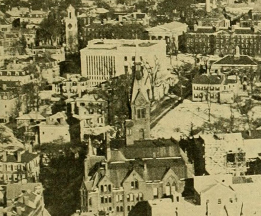
I’ve found a picture of the Paxton/Arsdale frontage. First, here’s the map oriented to the same viewpoint as the photographer…

Here we see the Waterman Street approach to the Brown University campus at the top of the hill, with the clock-tower in the distance. It’s 1909.

The twin pale buildings in the centre of the picture are the Paxton frontage. They have different roofs because they were once separate buildings, before being joined and painted alike. The resulting large boarding house was later called the Arsdale, then re-named again from 1946 as the male dormitory ‘Hopkins House’ housing some of the many Brown students returning from service in the Second World War. (My thanks to Ken Faig and David Schultz for discovering the later names of the place). Lovecraft lived at the back of this boarding-house and shared a courtyard garden and cats with it. His aunt ate either her main or midday meals here, and it seems that Lovecraft accompanied his aunt to festive meals here if he wasn’t in New York with the Long family. He may also have taken some meals here in the depths of winter. This was also the home of two of his late correspondents including Marion F. Bonner (for the letters see Lovecraft Annual 2015).
It’s also possible that Lovecraft would telephone from this building — there are two 1934 memoirs of Lovecraft in Lovecraft Remembered. In one, Kenneth Sterling discovers Lovecraft has no phone at home, in the other Dorothy C. Walter is telephoned twice by Lovecraft. Both are recalling 1934 at 66 College Street. In the Dorothy C. Walter instance Lovecraft was certainly at home, and would not have gone more than a few yards out of his door due to the bitter cold and ice outside. This suggests he may have made outgoing phone calls at the Arsdale, just across the garden court from 66 — unless perhaps the downstairs tenant at 66 had a phone that could be used. At the old address of 10 Barnes he had used his landlady’s phone for calls.
Update: my thanks to David Schultz for pointing out that the C.A. Smith letters indicate that Lovecraft’s aunt had a phone in her section/apartment of 66 College St.
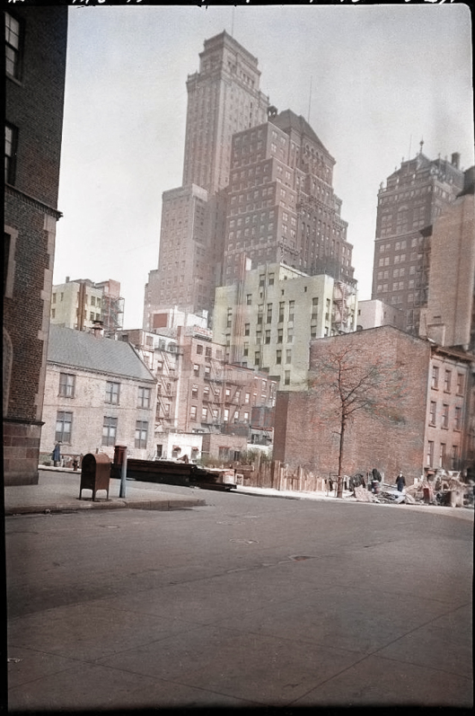
Here we seen a long view from the tall Industrial Trust building. It’s late January 1929 and we can just make out the back of the Paxton/Arsdale. One can just about make out the garden space between Lovecraft’s house and the boarding-house.

14 Saturday Sep 2019
Posted in Historical context, Maps
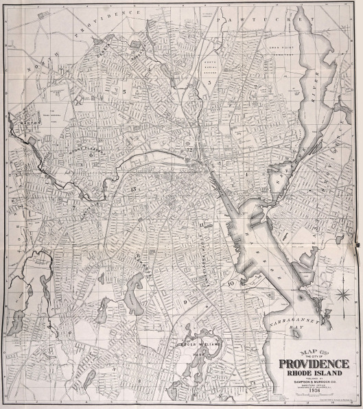
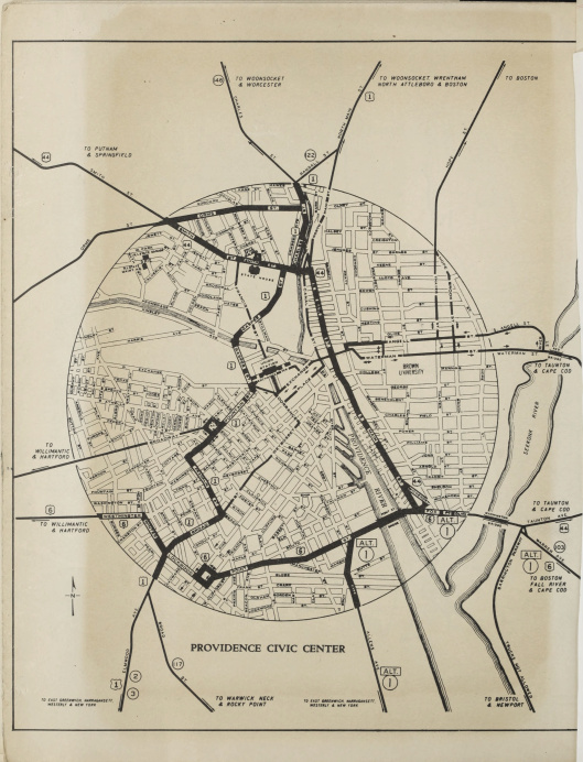
More maps useful to Lovecraftians…
1) A single-sheet street-map of Providence, 1936. If one squints a bit, about 70% of the street names can be made out.
2) A circa 1940 map of the central streets.
3) The Brown University campus, Providence, as it stood in 1928, including what were then the fraternity houses.

23 Friday Aug 2019
Posted in Historical context, Maps, New discoveries, Picture postals
≈ Enter your password to view comments.
12 Friday Jul 2019
Posted in Historical context, Maps, Picture postals

whilst conversing with natives there [in the witch-town of Salem], I had learnt of the neighbouring fishing port of Marblehead, whose antique quaintness was particularly recommended to me. Taking a stage-coach thither, I was presently borne into the most marvellous region I had ever dream’d of, & furnish’d with the most powerful single aesthetic impression I have receiv’d in years. Even now it is difficult for me to believe that Marblehead exists, save in some phantasticall dream.” — letter from H.P. Lovecraft.
Marblehead thereafter became one of Lovecraft’s favourite places as a New England antiquarian. His first visit to the town was at dusk and relatively brief, and its atmosphere permeates his story “The Festival”. He did not visit the harbour area at that time, but walked upward and onto the headland for sunset views over it, then returned down the winding streets in the gathering dusk (as in “The Festival”).
Did he ever visit the harbour and step down to the shore? I can find no evidence he did. But he returned to the ancient town again and again and must surely have, at some point, closely surveyed the shorelines and jetties, if only from a distance. His July 1923 visit for instance, ‘did’ a newly discovered built-up section which he found went right down to the harbour…
Verily, here alone survives the maritime New-England of yesterday, with the glamour of ships and the salt winds of eighteenth-century voyages.
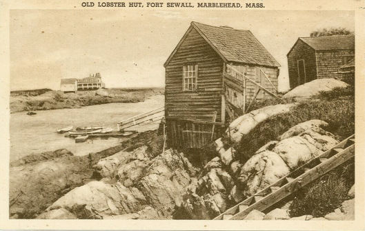
However, at Marblehead many of the lobster shanties appear to have been over on the Little Harbour, on the east side of the town. This was termed at that time a “cove at the lower end of the settlement”. Below is a map for orientation.

It may be objected that Lovecraft would have steered clear of going too close to an actual waterfront. Since, although a ship-captain’s sea-tang in the air seems to have been not unwelcome to him, he disliked the actual smell of fish. Yet here he is at Gloucester in 1927, exploring the still-working waterfront of the “really unchanged New England fishing port”…
one may actually get a lingering taste of old New England’s maritime past, along a waterfront filled with sail-lofts, ship-chandleries, and seamen’s missions.
Again, this doesn’t quite have him tromping down rough cobbled-stone slipways and then out along a sandy strand of loose grit and crushed lobster-claws. Which he might have encountered if he had walked over to Fort Sewall and down into Little Cove (or Little Harbour) in Marblehead. From the shacks at such places the fishermen worked as they always had. Lobstermen, in particular, still worked from shoreline structures such as those shown below, with their wooden lobster pots stacked up against the sides.


One could also see at Marblehead examples of houses which are basically fishing sheds, such as the ancient Gardner House (aka ‘Gardner Cottage’) now at 7 Gregory Street and “facing the quiet water of the tidal bay”…

A possible inspiration for Lovecraft? Well, there are many ‘Gardners’ in New England and, unless someone can dig up a “Nahum Gardner” here, there seems no reason to claim this place for “The Colour out of Space”.
What of other possible inspirations? Well, again one comes up empty. “The Lurking Fear” was written a year before Lovecraft discovered Marblehead. Thus it can’t be suggested that those particular shore shanties may have played into “Fear” settings such as…
The ground under one of the squatters’ villages had caved in after a lightning stroke, destroying several of the malodorous shanties; but upon this property damage was superimposed an organic devastation which paled it to insignificance. … The disordered earth was covered with blood and human debris bespeaking too vividly the ravages of daemon teeth and talon…
Nevertheless, there is a slim chance that there was some other shoreline encounter with “malodorous” shanties, likely surrounded by sun-bleached lobster detritus such as big claws (resembling “daemon teeth and talon”). That might be one possible real-life memory on which Lovecraft drew for this element in “Fear”, though there were doubtless others. It seems that lobstering was a craft practised pretty much all along the New England shoreline in suitable bays and coves, and that such big sun-bleached claws must have been a feature of shore-life. Such remains would have been a macabre if once-removed encounter with real-life deep ones.

What do the history books say? Well, they state that there had been a steady decline in lobster catches from the 1890s onward, probably due to over-fishing for the visitor trade. Then there were three prolonged cold snaps in a row, in the early 1920s, which soon made things quite tough for New England lobstermen by 1923. Worse times were coming, as tourist demand boomed in the hot summers of the mid 1920s and yet catches plummeted into the 1930s… just as the Great Depression really hit. Had Lovecraft actually met any old lobstermen on his travels in the 1920s and 30s, they would likely not have been very cheery people — in manner and sentiment probably much like old Zadok Allen of Innsmouth.
Thus, there seem to be no obvious aha! inspirations in the shanties at Marblehead. Oh well… one can’t expect to haul up new discoveries on every pictorial dive into Lovecraft’s places. But, those Lovecraftians looking for lobster and clam shacks in future will now at least be aware they were not only encountered by Lovecraft at the Joppa clam shanties at Newburyport (his main model for Innsmouth).
05 Friday Jul 2019
Posted in Historical context, Maps, Picture postals
H.P. Lovecraft’s correspondents were sent not only ‘picture postal’ postcards, but also lightweight brochure-leaflets from specific places. As America’s ‘visitor trade’ grew, in the late 1920s and early 1930s, Lovecraft could pick these leaflets up in stores, museum foyers, YMCA lobbies and the like. Presumably a keen visitor would be permitted to take a handful, if he promised the attendant he would ‘send them on to interested friends’. As Lovecraft became increasingly poor, such small items could have occasionally saved him the cost of buying pictorial postcards.

Above is a 1940 tourist map of the attractions and notable places around the town of Brattleboro. However, the map is identical to that on the reverse of this c. 1930 leaflet…

It may be of use to those trying to follow Lovecraft’s excursions out from the Goodenough farm in West Brattleboro, and the nearby Vrest Orton place. Such overview maps may be especially useful once we get the mammoth volume of Lovecraft’s complete ‘letters to the aunts’, due for publication soon. My guess is that we can probably expect to read there of a good many visits to obscure antiquarian shrines and remote mountain-vistas, all lovingly detailed. Possibly there may also be some mention of the 1927 Vermont floods at Brattleboro, though Lovecraft only saw the floods in pictures…
Lovecraft visited Vermont for the first time in the summer of 1927, returning in the summer of 1928. He did not actually witness the Vermont floods (a real event) [which gave rise to the story “The Whisperer in Darkness”], but they received extensive coverage in newspapers throughout the East Coast, and Lovecraft no doubt heard some first-hand accounts of them from several friends in Vermont including Vrest Orton and Arthur Goodenough”. — S.T. Joshi, A Subtler Magick.

 Pictures: the subsiding 1927 floods at Brattleboro.
Readers will recall Lovecraft’s “The Whisperer in Darkness”, opening with lines such as…
… country folk reported seeing one or more very bizarre and disturbing objects in the surging [1927 flood] waters that poured down from the unfrequented hills, and there was a widespread tendency to connect these sights with a primitive, half-forgotten cycle of whispered legend …
Spurred by finding the above Brattleboro map, I went looking for an update on the conservation and restoration of the Goodenough farmstead at Brattleboro. Apparently the farmhouse has a covenant on it which states that it’s to be preserved intact in its original form. The Goodenough Farmstead Trust began in 2004 and they spent $65,000 on the place in 2006. Most likely on the excellent new roof, to be seen below. The last online report from the place appears to be that of the Lovecraft fan Dakota Rodeo and friends, who visited in summer 2014 and found the house looking good but interior works still ongoing…
 Picture: local girls at the farmstead in 2014, visiting for Lovecraft’s birthday.
Also, where exactly is it? Joshi in A Subtler Magick places Orton just outside Brattleboro itself, and states that Goodenough’s farm was “further to the north”. Yet the local historical society has it that Goodenough’s hillside farmstead is on “the Goodenough Road in West Brattleboro”, which would place it west of Brattleboro. Lovecraft himself states that Goodenough… “dwells not much above a mile from Orton’s”, Orton having… “hired a delightful farm some miles out of Brattleboro, in Vermont” (Orton had recently fled New York and the south Windham County house was on a long all-summer lease, not just a week’s holiday-let). Given this, Joshi’s “further to the north” must indicate “to the north” of Orton’s place, not north of the town itself.
While looking for Orton’s actually address I found additional interesting confirmation that that he and Lovecraft would have chimed politically. The author of a 1989 tourist book on Vermont had looked through Orton’s famous mail-order publications and noted their politics…
Vrest Orton, whose tartly conservative political views punctuated the [his] enormously successful mail order catalogue Voice of the Mountains“. — The roadside history of Vermont, 1989.
Voice was issued by Orton’s business the Vermont Country Store, and a collection of his columns were later published as the book The Voice of the Green Mountains: a collection of phillipics, admonitions & imponderables (1979). Orton’s late recollection of Lovecraft, first published 1982, also made a passing remark on Britain’s increasingly sorry state under socialism. This implies that i) his political views had not changed over time, and that ii) his memoir was likely penned some years earlier, perhaps in 1976-79, when Mrs Thatcher had not yet been elected.
But… back to finding the precise location(s) of Goodenough and Orton in the 1920s. If the Goodenough farmstead’s location is the address at which the Goodenough Farmstead Trust is formally registered today (and satellite photography in Google Earth suggests it is, offering the same building layout, roof shape, and arrangement of of the grounds) then that puts it about five miles directly west of Brattleboro itself. This further suggests that Orton’s springwater-fed and oil-lit “eighteenth-century” place may have been in the hills somewhere off Akley Road, about a mile south of the Goodenough farmstead. Orton’s late memoir of Lovecraft actually puts his rented place at “ten miles” from town, but no doubt Orton recalled every hairpin bend and switchback in that tally, as the neighbour’s Ford rattled along the back-roads through the hills. Here is Lovecraft, recalling the journey up into the backroads…
“The nearness and intimacy of the little domed hills become almost breath-taking — their steepness and abruptness hold nothing in common with the humdrum, standardized world we know, and we cannot help feeling that their outlines have some strange and almost-forgotten meaning, like vast hieroglyphs left by a rumoured titan race whose glories live on in rare, deep dreams.”
 Picture: Brattlboro is the large town seen along the river on the right of the picture, and Guilford / Old Guilford straddles the road that runs south out of it. The curious line seen marching across the landscape near the farmstead, like an ancient Roman wall, is presumably a forest fire-break to protect the town? Despite being marked on the old tourist map as forest it probably would not have been quite so thickly wooded back then, because there has been massive forest ‘re-growth from farmland’ in the eastern USA since the 1930s, along with a general global greening since the 1990s.
There is a slightly curious place-name puzzle here. Orton’s newspaper report “A Weird Writer Is In Our Midst” (1928) states that Lovecraft’s 1928 visit was at “Guilford”, which the modern maps mark at about a mile and a half south of the centre of Brattleboro. He is “stopping with us in Guilford”, writes Orton in the newspaper. This is apparently confirmed by the title of “Literary Persons Meet in Guilford” Brattleboro Daily Reformer (18th June 1928). And yet Orton’s later memoir of Lovecraft clearly states that the location of the 1928 visit was his rented summer house, near the Goodenough farmstead, and that this was “ten miles from Brattlboro”.
But we know that the “Literary Persons Meet in Guilford” meeting was definitely held at the Goodenough farmstead. The local newspaperman was at the farm in person and reported… “Half a dozen literary persons met for a discussion yesterday at the home of Arthur Goodenough”. Lovecraft himself reported to fellow amateurs that… “there was a literary assemblage of much interest at the poet’s abode”.
The solution to this small riddle must be that, to local people, the place was considered to be part of Guilford. Even though Guilford/Old Guilford was many miles east-away toward the river, through the rolling hills. Indeed, looking more closely at the maps one can see a “West Guilford” area extending out toward the Goodenough farmstead.
 Picture: Typical covered bridge and packed-dirt road, of the type then found in Guilford and Brattleboro.
07 Friday Jun 2019
Posted in Historical context, Maps, Picture postals
Here we see the corner of Joralemon St and Clinton St., Brooklyn, then on the edge of Red Hook. H.P. Lovecraft lived just a short walk from this spot, in a “dismal hovel” at 169 Clinton St., also right on the edge of Red Hook. During his time here he…
often” ate at “Peter’s in Joralemon St.” (Selected Letters II)
Thus he may have known the corner well, as he often walked down from his apartment and around the corner to eat in a Joralemon St. cafe. Joralemon St. goes both ways from the intersection, as you can see from the map below. Since the precise cafe location is currently unknown, then the direction in which he would have turned off Clinton St. is also unknown.
The photographer was Percy Loomis Sperr, and the date is 22nd February 1930. Which is only a few years after Lovecraft had left.
As for Lovecraft, the man seen walking into the right of the picture, or the man seen on the left contemplating the wasteground, both seem like close stand-ins for him (perhaps they’re Sperr’s bodyguards, which a cameraman with a valuable camera and tripod might need in Red Hook). Although by this date the master was safely back in Providence, and musing on the opening lines of “The Whisperer in Darkness”.
Here’s my useful map for future researchers in this part of Brooklyn. I used Photoshop to combine four such maps, which show building-level numbering and street layout. It’s centred on Lovecraft’s 169 Clinton St. Bear in mind that it’s from 1884, so is only to be used for initial orientation. Specific details for your chosen time period will need to be confirmed by consulting later maps.
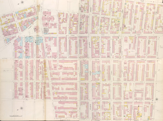
It seems that Clinton and Atlantic broadly formed the boundaries of what was then thought of as Red Hook. Which means Lovecraft was living right on its edge. Evidently it was not a salubrious edge. Lovecraft’s decrepit mouse-infested lodgings were noisy, smelly, and the apparently genteel Irish landlady quickly proved to be none too particular about who she took in as lodgers — an adjacent room harboured shifty youths who stole Lovecraft’s clothes and left him only what he was wearing.
Below Columbia St., seen along the very bottom of the map, the long waterfront of sailor-bars and wharfs and warehouses began and ran down for a few blocks before thrusting out into a series of ship-piers. Experts on the waterfront’s history say little online about the 1920s and 30s, but can say that until the public works of the mid to late 1930s there were still shantytowns, open scrubby land and undrained marshland along the waterfront. Eastern parts of Red Hook were also heavily dotted with “weedy undeveloped terrain” on 1924 aerial photography, and a Thomas Wolfe short story of 1936 (which concurs with Lovecraft’s description of Red Hook) would put this area at “Erie Basin”.
Searches of Google Books reveal that, back of this waterfront area, the built-up residential part of Red Hook seen on the above map mostly had a population of poor Italians from the south of Italy, split into dialect groups that had great difficulty comprehending each other. Red Hook also had some large, though possibly dwindling, Irish groups until the later 1930s. Further there were significant numbers of Syrians who were almost all Christians escaping persecution, according to the book An Ethnic and Racial History of New York City — although Lovecraft wasn’t to know that from listening to their “eldritch” music through the walls of his apartment. There were even a few old Norwegians and Finns (classed as “Swedish” in reports), left behind after earlier waves of immigration had left the area c. 1900-1910. Presumably many of these remainers were old sailors and this may especially interest some, in terms of Lovecraft having a Norwegian sailor be central to the plot of The Call of Cthulhu. Mixed in with Red Hook’s two majority populations of Italians and Irish were floating populations of active sailors on shore-leave from all over the world. There was a small permanent Caribbean population in Red Hook at 1920, perhaps families of sailors, and these may be the same as those noted in a 1927 report as being tiny colonies of Porto Ricans and black Brazilians. Mingling among the transient sailors were the many illegal arrivals, spurring occasional raids into Red Hook by the immigration authorities. In “Red Hook” Lovecraft thus appears to have got the demographics right, except that he substituted the Spanish (not yet in Red Hook, at that time) for the Irish. Presumably he made this change because his detective protagonist is Irish.
One academic has claimed in the New England Review that Lovecraft was right about there being Kurds in Brooklyn, the claim being based on the rather idle assumption that the modern Kurdish community has always been there. That is not the case. The current Kurdish community only arrived there in 1975 when the U.S. resettled 700 people. Brooklyn’s Kurdish Library was opened in 1989 and by the early 1990s there was a community of 2,000 (Encyclopaedia of New York City). Thus the modern community, centred on North Gowanus which is now Boerum Hill, cannot plausibly be ‘mapped back’ onto any Kurds Lovecraft might have encountered in Brooklyn in 1925. Indeed, Lovecraft correctly states in “Red Hook” that Gowanus was then home to a relic population of Norwegians. I can add that there had been a failed Sheikh Said rebellion of the Kurds in February-March 1925, and this might just have caused some richer Kurds to try to get to New York City. “The Horror at Red Hook” was written 1st-2nd-August 1925, and thus Lovecraft might had seen and felt a small but noticeable influx of exiled Kurds entering clandestinely into Brooklyn in May-June-July. But that is speculation, and I can find no confirmation of any newly-arrived Kurds in Brooklyn in 1925.
On the area S.T. Joshi remarks, in I Am Providence…
It [Red Hook] was then and still remains one of the most dismal slums in the entire metropolitan area. In the story Lovecraft describes it not inaccurately, although with a certain jaundiced tartness:
‘Red Hook is a maze of hybrid squalor near the ancient waterfront opposite Governor’s Island, with dirty highways climbing the hill from the wharves to that higher ground where the decayed lengths of Clinton and Court Streets lead off toward the Borough Hall. Its houses are mostly of brick, dating from the first quarter of the middle of the nineteenth century, and some of the obscurer alleys and byways have that alluring antique flavour which conventional reading leads us to call “Dickensian”.’
Lovecraft is, indeed, being a little charitable (at least as far as present-day conditions are concerned), for I do not know of any quaint alleys there now.
Photographs show large parts of Red Hook being erased by massive ‘housing projects’ (UK: ‘tower blocks’) in the late 1930s, so the alleys Lovecraft evoked may once have actually existed.

I’ve given the opening picture of Joralemon St. and Clinton St. a new light colorisation. Architectural record photographers such as Sperr tend to prefer very quiet times to make pictures, and we can thus assume that at other times this scene would have been alive with children, food-carts, vehicles, pedestrians, and other obstructions to making a record-picture. Here is a 1923 picture indicative of the sort of Italian/Irish New York street-corner life Lovecraft would have had to weave his way through to reach his cafe. Though one imagines that the affluent lady in the open chauffeur-driven car would have been a rare sight, in that part of New York…
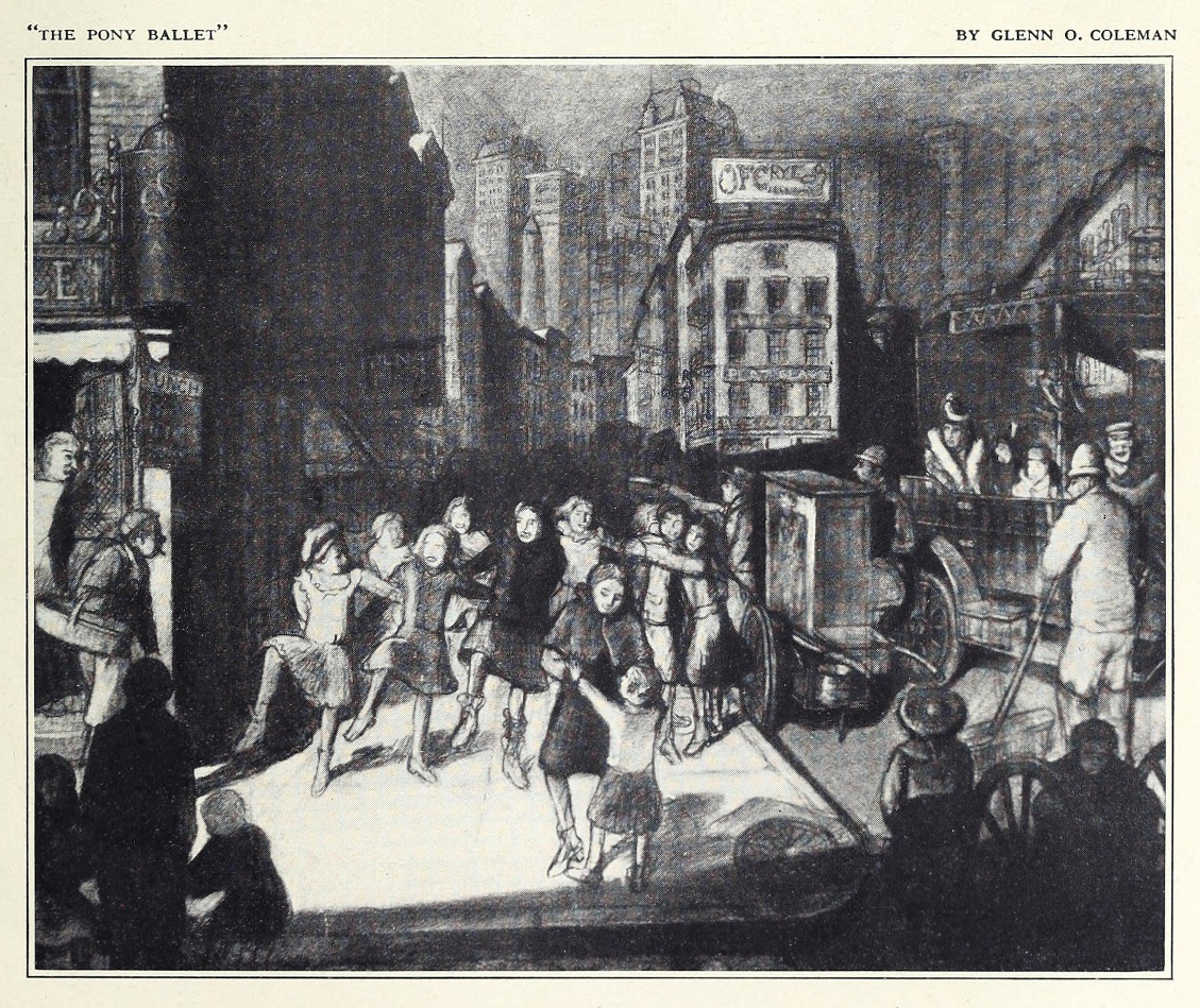
Picture: Glenn O. Coleman, “The Pony Ballet”. A pony ballet was a very high-kicking chorus-girl dance-line, presented on the stage by the younger dancers in a theatre troupe. It usually formed an interlude between acts at a variety theatre.
In terms of the appearance of the streets we should also take into account the extreme weather in New York City during Lovecraft’s time there, which would seasonally have radically changed the nature of the streets. Such as the worst snowstorm in living memory from 1st-3rd January 1925. Lovecraft had barely moved in to his “dismal hovel” at 169 Clinton Street, on 31st December according to the date I have, before the storm hit the city. Then a searing killer heatwave settled on the city in June of 1925. There was a similar but slightly less searing heatwave in July 1926, though by that time Lovecraft had left New York. Worse was to come, as can be seen from this EPA chart, but Lovecraft was able to enjoy these in far more comfort. Indeed, it might be said that without the 1929-37 heatwaves, he would not have lived as long as he did…

23 Thursday May 2019
Posted in Historical context, Maps, New discoveries
≈ Enter your password to view comments.
18 Saturday May 2019
Posted in Maps

From The southern gateway of New England, 1910. Map possibly drawn up 1903, when H.P. Lovecraft would have been about age 12 to 13, and still roving far on his bicycle.

And the 1916 update, less visually pleasing but with new additions and with the colour key explained in the small-print. Lovecraft now a young man of about age 25, having long since given up his bicycle and row-boat in favour of zipping about on trolley-cars (trams).
17 Friday May 2019
Posted in Astronomy, Maps, Picture postals

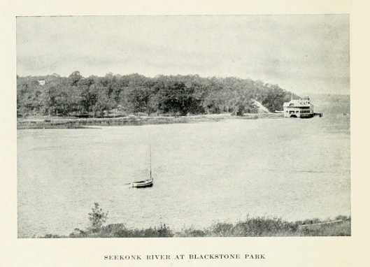
The lower Seekonk shoreline does not seem to have been much photographed for postcards, and there are few postcards of it online and only one of York Pond itself (after the grading and extraction works). This is the largest I have of this particular card.
Here’s H.P. Lovecraft on the Park and shoreline…
“Scarce a stone’s throw from the house lie the nearest parts of that beautiful rustick reservation known as “Blackstone Park” — wherein I have been wont to wander some twenty or more years [i.e. since about age eight]. Here Nature unadorn’d displays a multiplicity of agreeable phases; ravines, groves, brooklets, thickets, & Arcadian stretches of river-bank — for the park borders on the wide & salty Seekonk. The Seekonk is call’d a river, but in truth ’tis but a bay or inlet. The river proper doth not begin till four miles to the north, where (changing its name successively to the Pawtucket & the Blackstone) its fresh streams flow over the mill dam at the Great Bridge of the city of Pawtucket. How beauteous indeed is untainted Nature as beheld in so idyllick a spot as Blackstone Park! […] I think this park would explain why such a born & bred town man shou’d possess such a taste for rural musings & Arcadian themes!
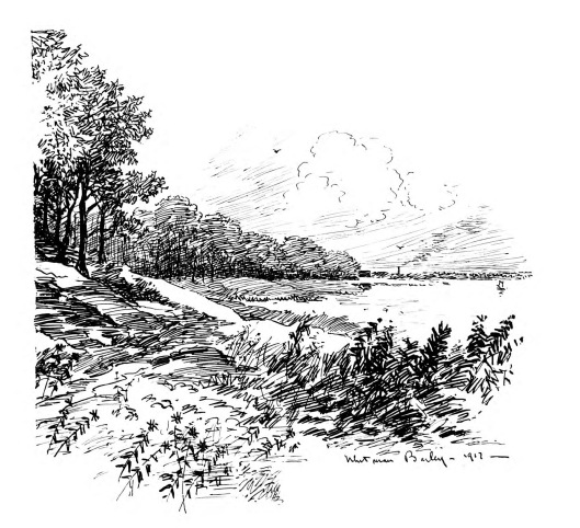
Here’s a Blackstone Park sketch made by Whitman Bailey in 1916. Looking down a sylvan path and ride, toward the glinting of the distant Seekonk.

The young Lovecraft also had a view of the Park and the Seekonk from his home…
“The roof of 598 Engelstrasse is approximately flat, and in the days of my youth I had a set of meteorological instruments there. Hither I would sometimes hoist my telescope, and observe the sky from that point of relative proximity to it. The horizon is fair, but not ideal. One can see the glint of the Seekonk through the foliage of Blackstone Park, and the opposite bank is quite clearly defined.”
One can glimpse a house with a flat roof and just such a view here (from The southern gateway of New England, 1910). The picture-maker looks across at the shore ride, from near Red Bridge…
The shoreline structure seen here is the Boat Club boathouse, thus by looking at maps one can see that the house glimpsed in the trees is likely to be one of those lining Lovecraft’s Angell St.


As one can also see above, the shoreline road was relatively low. No attempt seems to have been made to preserve the shore drive from being covered by the inevitable ten-year winter flood-surge. Indeed, Lovecraft dreamed of such things, but weirdly inverted and horribly revealing rather than covering…
“I was standing on the East Providence shore of the Seekonk River, about three quarters of a mile south of the foot of Angell Street, at some unearthly nocturnal hour. The tide was flowing out horribly — exposing parts of the river-bed never before exposed to human sight. Many persons lined the banks, looking at the receding waters & occasionally glancing at the sky. Suddenly a blinding flare — reddish in hue — appeared high in the southwestern sky; & something descended to earth in a cloud of smoke, striking the Providence shore near the Red Bridge — about an eighth of a mile south on [of?] Angell Street. The watchers on the banks screamed in horror — “It has come — It has come at last!” — & fled away into the deserted streets. [Blind panic ensues] By this time the river-bed was fully exposed — only the deep channel filled with water like a serpentine stream of death flowing through a pestilential plain in Tartarus.” (1920)
There evidently were floods but the natural inundations of winter were brief, expected and subsided. In summer he would often sit all day on the surviving southern bluff above York Pond, reading and writing. In 1927, a letter was headed as from… “High Wooded Bluff Above the Seekonk River – a mile East of 10 Barnes St.” He sometimes even shared his childhood haunt with close friends. Here is an instance from 1927…
“the next day we [he and Cook and Munn] lounged about the Blackstone Park woods beside the Seekonk — agrestick haunt of my earliest infancy, and true genesis of my pastoral soul.”
In a letter of 1934 he remarks…
Almost every warm summer afternoon I take my work or reading in a bag & set out for the wooded river-bank [on the Seekonk] or the fields & woods north of Providence — spending the time till dusk in one or more favourite rustic spots.
A year after Lovecraft passed away, a terrific natural flood struck Providence…

This must surely have also swept up the Seekonk and around his cherished wooded bluff in Blackstone Park, but understandably there seems to be no photo made of the Park shoreline at that time. Evidently the foliage and wildlife of the ponds at that point must be used to such occasional inundations.
17 Friday May 2019
Posted in Historical context, Maps
H. P. Lovecraft was once something of a waterman on the Seekonk River, seen above in a Whitman Bailey drawing made on the Poe-haunted west shore at Blackstone Park…
“I used to row considerably on the Seekonk … Often I would land on one or both of the Twin Islands — for islands (associated with remote secrets, pirate treasure, and all that) always fascinated me.” — Lovecraft letter to Rimel, April 1934.
The islands are locally known as Cupcake Island and Pancake Island, indicating their respective shapes. Though these may be modern post-1945 names. There appears to be no vintage photograph, sketch or postcard of them, available online. But one can see them on this map…

They can also be seen on some of the earliest maps of Providence, c. 1650…


From where and how would the young Lovecraft row? One imagines that, once old and strong enough to row alone on a large river, he might have been allowed to take out a row-boat from the Boat Club boathouse (opened c. 1884). The name of his grandfather probably still had some sway with Club, and he might have avoided the sort of hire-fee he could have had to pay at Red Bridge. The boathouse can be seen here…

The residential house seen through the trees is one in Angell St., so that indicates Lovecraft’s proximity to the boathouse. The boathouse had an interesting gothic look from a certain angle…

Lovecraft must have been no puny stripling at this time, for the Seekonk could be a dangerous river and the city Report noted that a rescue crew patrolled the river on Sundays and holidays circa 1912. Today the Brown University men’s rowing team notes that…
The Seekonk is known for its difficult rowing conditions, particularly heavy wind and waves, as well as a strong current.
Thus perhaps we can assume a Lovecraft who was aged 14 or 15, circa 1904 or 1905? Lovecraft might not have encountered the Brown rowing team’s twice-daily training (they apparently had another boat-house nearby). As evidenced by the statement… “The Brown Alumni Monthly has been for years in favor of the resumption of rowing at Brown” (1915), implying that the team might have been moribund for a number of years prior to 1915.


In his row-boat experience, and the island encounters amid the shifting sediments, do we glimpse the personal roots of his famous story “Dagon” (July 1917)? His nightmare of the Seekonk River draining away to reveal primal ooze was recounted in a letter of May 1920 (“the river-bed was fully exposed — only the deep channel filled with water like a serpentine stream of death flowing through a pestilential plain in Tartarus”), but Lovecraft called this a “typical dream” — thus there may have been similar pre-“Dagon” dreams. Indeed we know there were, as he later wrote of “Dagon” that… “I dreamed that whole hideous crawl, and can yet feel the ooze sucking me down!” If this latter dream was of the drained Seekonk or not, must now remain unknown. But the likelihood is that it was.
The flow of the river was probably faster then, because its main flow was in a far narrower and shallower navigation channel of 12 feet, this being “the deep channel” referred to by Lovecraft. Only in 1927 did a U.S military dredging project dredge a longer and deeper… “3.4-mile-long channel, 16 feet deep” all the way from East Providence to Pawtucket. “The channel is 150 feet wide from the Red Bridge to an area opposite Goose Point where it widens further to 230 feet.” (U.S. Army, Seekonk River Navigation Project).
His ‘considerable’ rowing experience on the Seekonk may also help explain his extreme delight in the header illustration he had in Weird Tales, for “Dagon”, since he would then see in it not only an illustration of the story, but also a reflection of his own experience of rowing on the Seekonk…

Presumably such things were cast off along with his bicycle, which he ceased using altogether in the summer of 1913, long past the point when he was expected by local convention to shed such boyish activities. As his family descended into poverty, he may anyway have lacked the hire-fee for such a boat.
See also: the mysterious river island in “Dreams in the Witch House”…
She had told Judge Hathorne of lines and curves that could be made to point out directions leading through the walls of space to other spaces beyond, and had implied that such lines and curves were frequently used at certain midnight meetings in the dark valley of the white stone beyond Meadow Hill and on the unpeopled island in the river. […] He [later] rowed out twice to the ill-regarded island in the river, and made a sketch of the singular angles described by the moss-grown rows of grey standing stones whose origin was so obscure and immemorial.