This week on ‘Picture Postals’, my hand-tinted version of a nautical map of Providence Harbour and the lower Seekonk in 1896. In the Seekonk (here the ‘Pawtucket River’) we see the ‘Twin Islands’ on which the youthful Lovecraft used to land in his rowing-boat. High-res at 4600px and 300dpi.
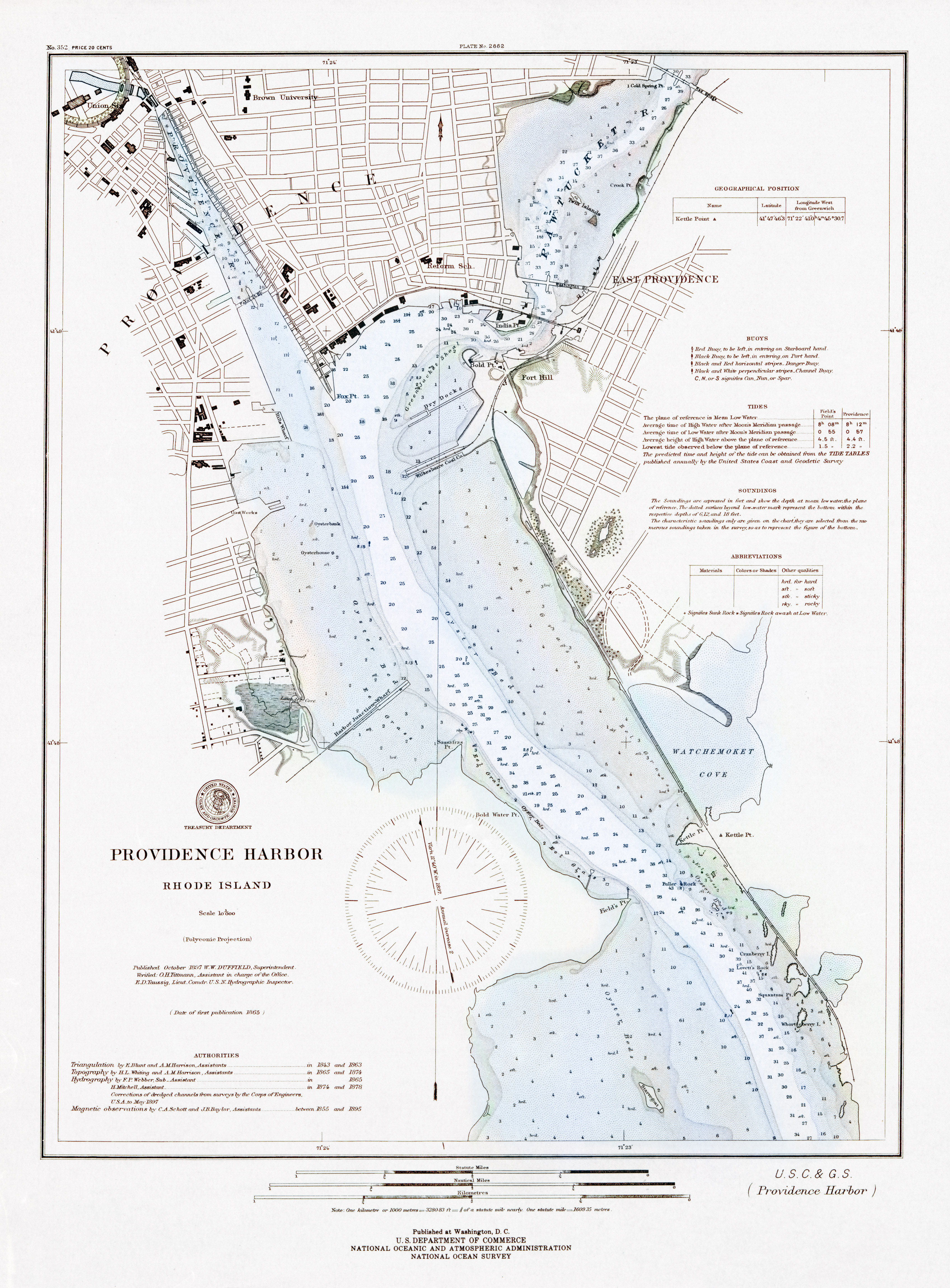
Brown University at the top, Starvegoat Island at the bottom. This map seems to have some RPG potential, as at that time a lot of infilling had not yet occurred. Lots of coves and marshes and eel-grass meadows in which Things Might Lurk.
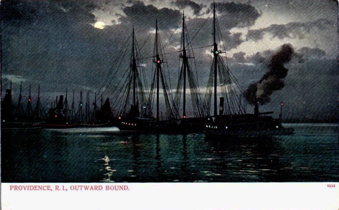
And here’s a more poetic surface view, though also work-a-day since there were still tall-masted ships working the harbour in Lovecraft’s early youth…