
This week on ‘Picture Postals’, another map and also a departure from the Providence theme. New York City’s subway and ‘elevated’ railway system in 1925, drawn by E.R. Trott and given away to customers by a large hotel. In Red Hook Lovecraft was living in the bottom-right corner of the map. See “CLINTON” written in capitals at an angle, and then find “Atlantic” and intersect the two… and you’re about there.
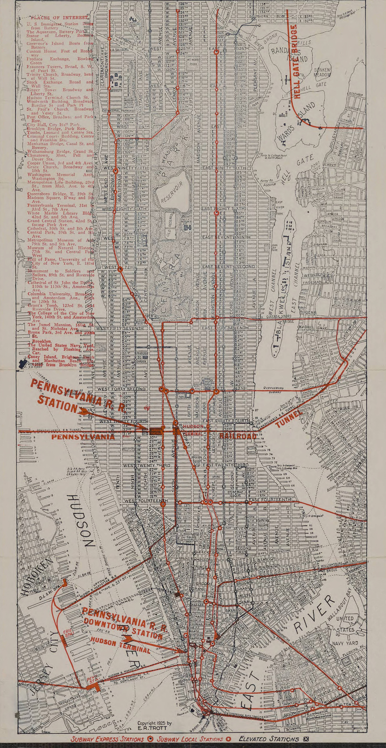
2988 pixels on the longest side, and thus readable if downloaded at full size. A very useful map if reading Lovecraft’s 1925 Diary and letters from New York, since it also has many of the street names, parks, ferry lines, museums, libraries, and even the dock numbers. All for 1925.
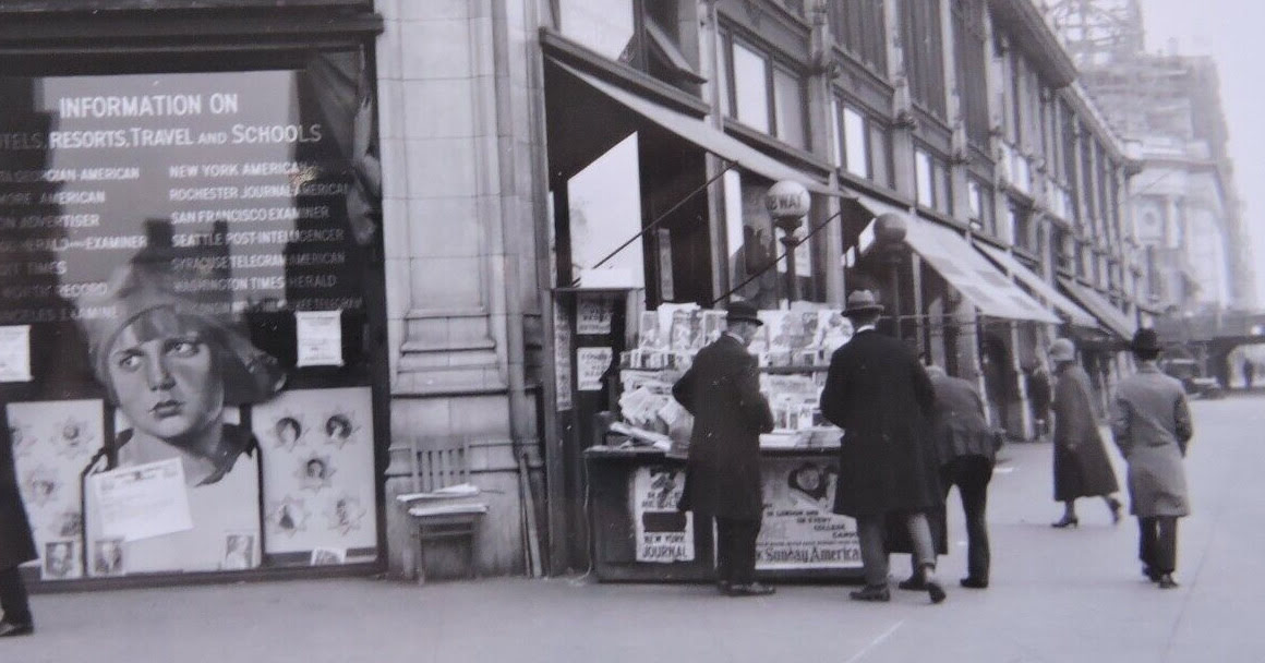
And to bring the map somewhat to life, here we glimpse a typical subway entrance with news-stand, at Columbus Circle in October 1925. On one of the southern corners of Central Park…
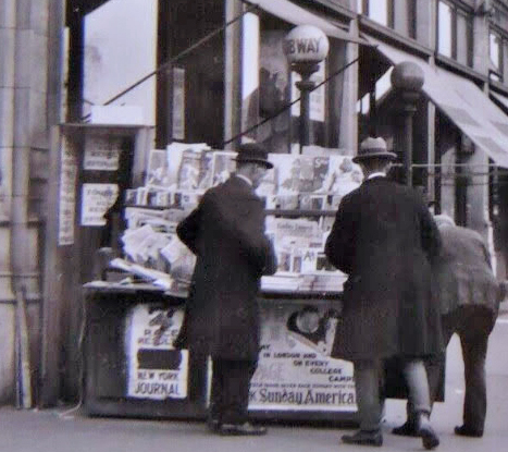
Note the news vendor’s baseball bat, ready to hand. Hoodlums got what was coming to them, in those days!