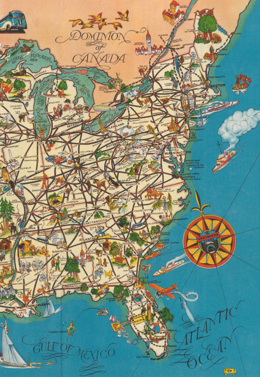
The eastern part of America, visualised as a map of the Greyhound long-distance bus routes for 1935.

Lovecraft was, of course, an experienced bus-hopper in the summer months. Though in his later years his poverty could usually only countenance the cheaper options for such transport, and the Greyhound lines were not the cheapest….
“We’ll have to investigate Chauncey. Westerly coaches pass through Hope Valley (so do the New York Greyhounds), but the fare is probably rather formidable.” — letter to Morton, January 1933.
He may also have juggled a cheaper fare by not going all the way…
“I generally proceed by coach out some main highway, then striking across country afoot till I reach another coach-bearing highway along which I can return. In this way I have explored many regions which I never saw before — some delectably-unspoiled” — 1933 letter.
Still, the map is indicative of the key destinations that could be reached by the long-distance coach-bus routes, and may be something to print out and slide in alongside the volumes of his letters. In order to keep track of him, as he reels off the more major placenames to his correspondents. The more fine-grained map of his home ground, which I posted here earlier, would be needed for the smaller little towns and settlements in Mass. and Rhode Island.
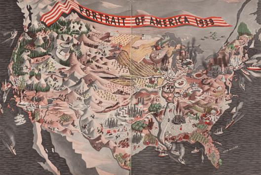
More generally useful, especially for those outside the USA, is an Erik Nitsche map of the ‘mental picture’ that Americans had of the nation’s patchwork of regions in 1939, without all the state lines confusing matters…

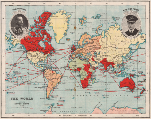
I also found a good map of the British Empire, as the Anglophile Lovecraft would have known and understood it, in a map of 1929…

The dozy-looking “Prince in whom we all delight” turned out to be a duffer, but was replaced by someone better (see the excellent movie The King’s Speech for the story).


