
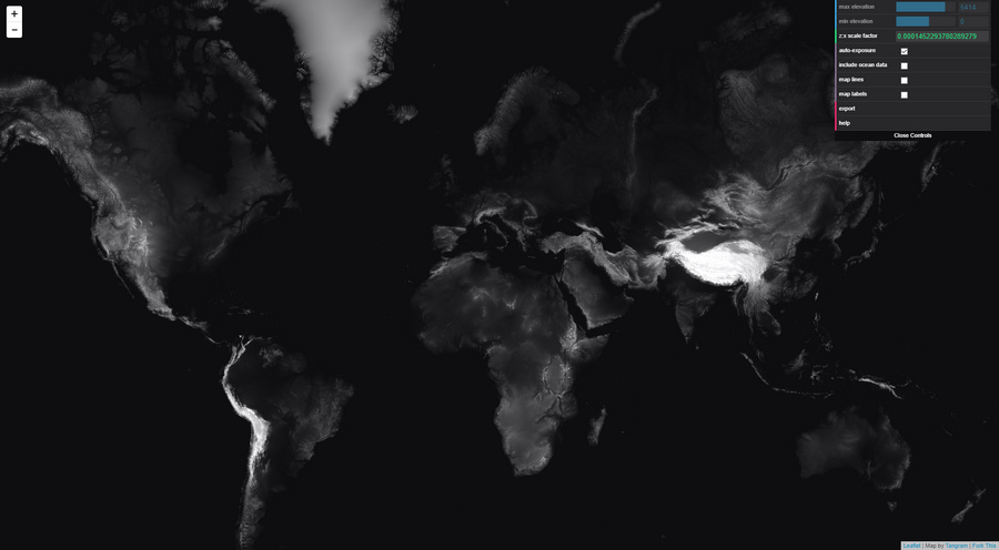
Seamless and free height-maps for the whole world, now at Tangram Heightmapper. It’s very easy to use. Once you’ve dived down to your location, and exported such a map, these height maps can be imported into 3D software. There they can then be used as the basis for making new elevated terrain maps, and as pretty as you care to make them.
How to use…
1. Go to Google Maps. Find your chosen location, and position it. Copy the current Google Maps URL to Notepad.
2. Now use this Google Maps URL co-ordinate data to craft a new URL for the Height Mapper. An example Google Maps URL would look like…
../maps/place/Your_place/@53.0220219,-2.2297826,12z/
Therefore the needed Tangrams Height Mapper URL would be…
https://tangrams.github.io/heightmapper/#12/53.0220/-2.2297
The #12 appears to be the zoom-level, with #13 zooming the satellite down another mile or so nearer to the ground. It appears to correspond with the ,12z bit of the Google Maps URL. It thus seems someone could easily cook up an URL-converter UserScript for Google Maps, but for now it needs to be done manually.
3. Paste your newly-crafted URL into Tangrams Height Mapper. Allow time to load. Once you’re happy, press “Export” to get the heightmap in PNG.
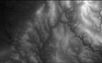
If needed, zoom-in further and grab multiple adjacent sections for export, then stitch these with the free Microsoft ICE. Although this does not appear to add detail. It just makes the final image larger. Nor can the upres-er AI Gigapixel add much new detail.
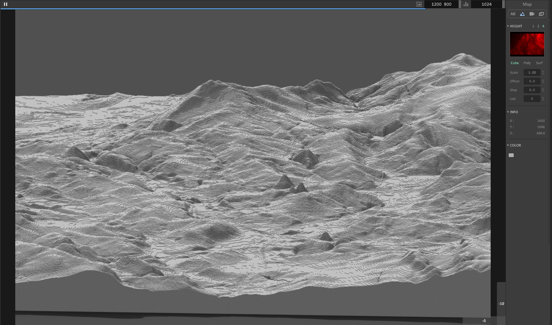
4. View in your chosen 3D landscape software by loading up your new height map. For a quick look, the Aerialod freeware is simple and will do the trick.
You will then likely find the height map has “terraces” (aka “stairsteps” or “steps” or “zippers” or stepped “waterlines” or “tidelines”). These look like the tiny lines following the contours of a drawn map. These are not actually drawn-on contour-lines, but rather the unwanted artefacts of the relatively low-resolution heightmap. If you want high-resolution heightmaps you’re assumed to prospecting for oil or gold and you generally have to take out a mortgage to afford them.
Seen here in Aerialod, this “stepping” effect is actually not unappealing when rendered crisply. Though here with a bit too much of the Minecraft game about it. You can hide this effect somewhat by switching Aerialod to display in ‘Poly’ or ‘Surf’ mode, but these modes make the terrain look like a plaster-cast and seem far from ideal.
5. Most will then want to find a method of smoothing these tiny terraces, but without removing too much detail from the real bits of the terrain. Sadly it appears there’s there’s not really any way to do that, without smushing the other details, other than to cover the terrain with a satellite map or apply textures.
One simple free option that I find works for mesh export is Height Map to OBJ. This gives a smoother 3D mesh as it exports, though also regrettably smushing fine details, rather than trying to smooth the height-map pixels first. It’s old but, like most good Windows freeware, still works and it will get rid of the ‘terraces’. Just note that the height maps you feed it must have exactly square dimensions. On import of the resulting OBJ into 3D software you may find you have to re-set the scaling, to something like 700% on the Y axis.
With a vastly steeper learning-curve, TerreSculptor is now free and will also import a height map and export an OBJ.