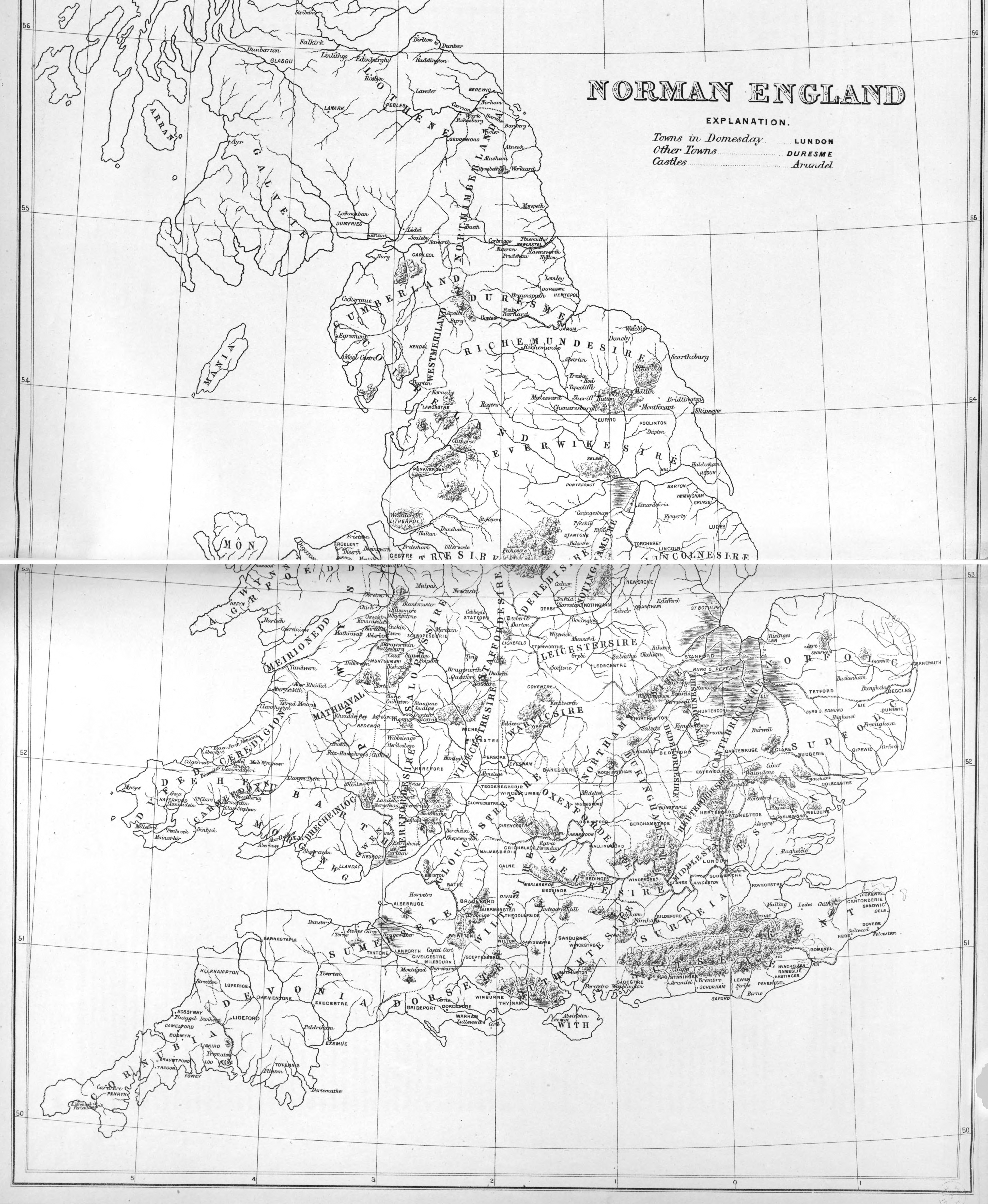
Maps for Saxon Britain and Norman Britain. From Charles H. Pearson, Historical Maps of England, 1883, third edition revised.
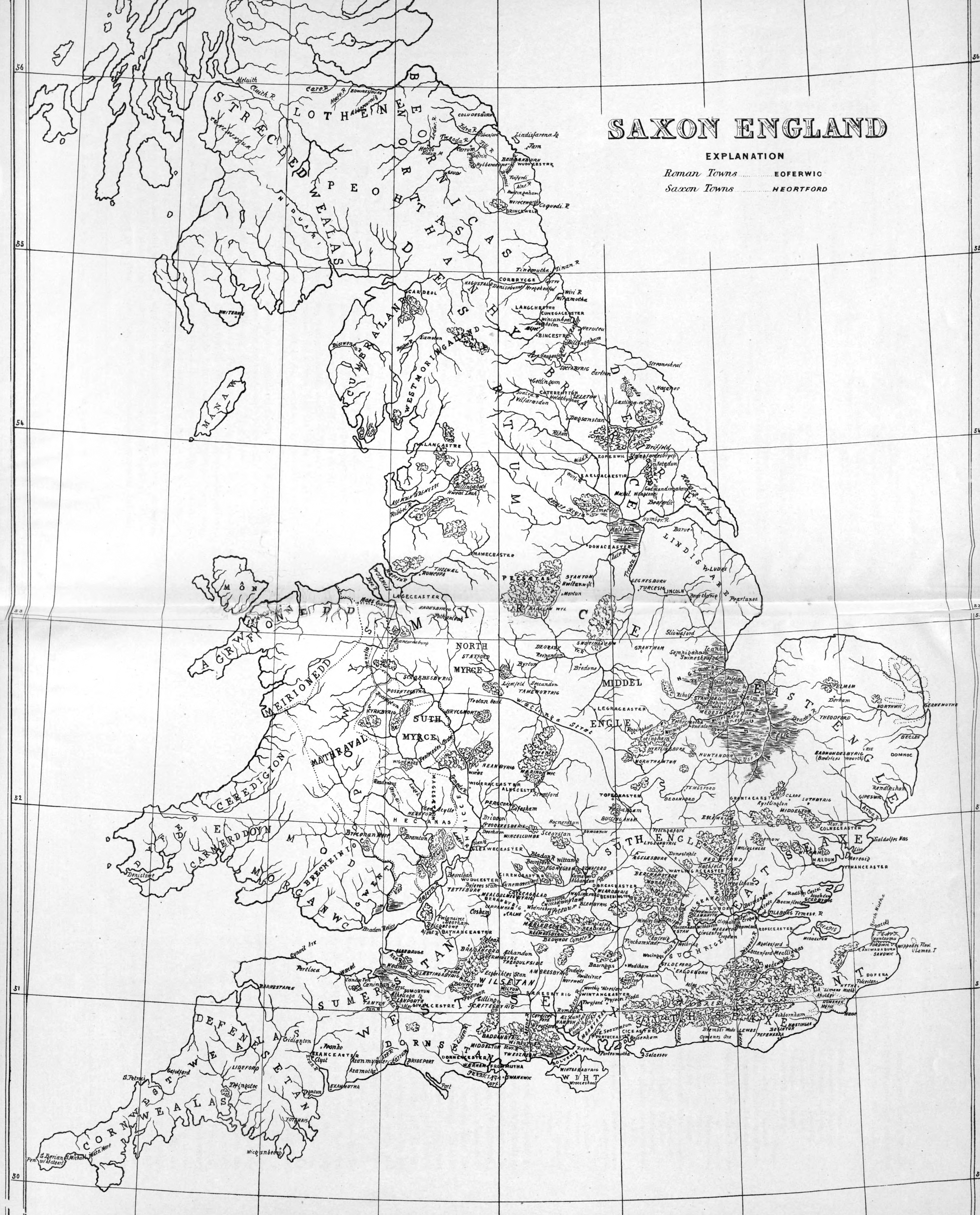
At the edge of The Peak, “Badecan Wyl” is ‘Badecan’s Well’, or today the town of Bakewell.
Maps for Saxon Britain and Norman Britain. From Charles H. Pearson, Historical Maps of England, 1883, third edition revised.
At the edge of The Peak, “Badecan Wyl” is ‘Badecan’s Well’, or today the town of Bakewell.