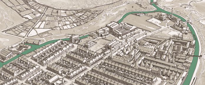
Interesting bird-eye map of Middleport, from The Burslem Port Trust. I just couldn’t figure it out, until I realised it’s not now or the future. It must show Middleport way back when the Trent & Mersey Canal Arm (‘Burslem Port’) was still flooded. Which would put it at the 1940s, and with the map presumably being drawn from the late-1940s RAF pictures of Stoke-on-Trent. The allotments above Rogerson’s Meadow are in ‘full spread’. A large chunk of them were fallow when I lived there. Interesting that the Meadow may once have had a shallow pool in the centre of it (seen on the far left of the picture). It always was a bit damp.
Re-Form Heritage is now calling for Middleport memories and objects, for their refurbished terraces in Harper Street. Especially “those authentic items that would have been in the house – ordinary items small or large”. These can be donated or given on-loan.