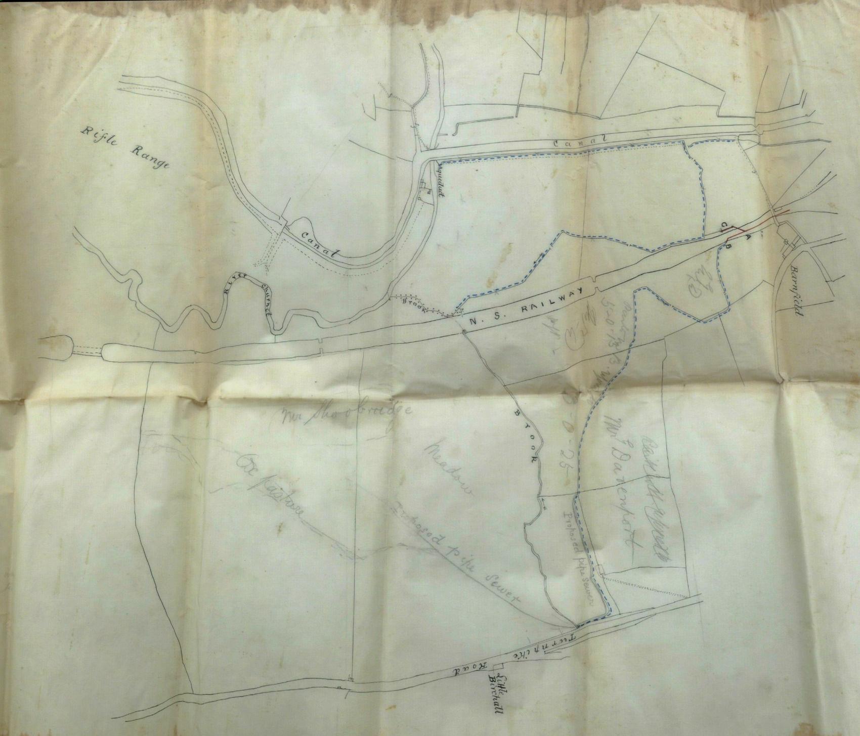
An old railway surveyor’s map of the Churnet, showing the railway and the canal. Likely to be of interest to someone, especially those interesting in flooding in the Moorlands and exactly where the old drains ran (one is marked on the map in pencil and, since it was put in by the railway, is probably still there). Placenames are Barnfield, Little Birchall, and a route still labelled as a “turnpike”. Appears to be about where the Country Park is today.