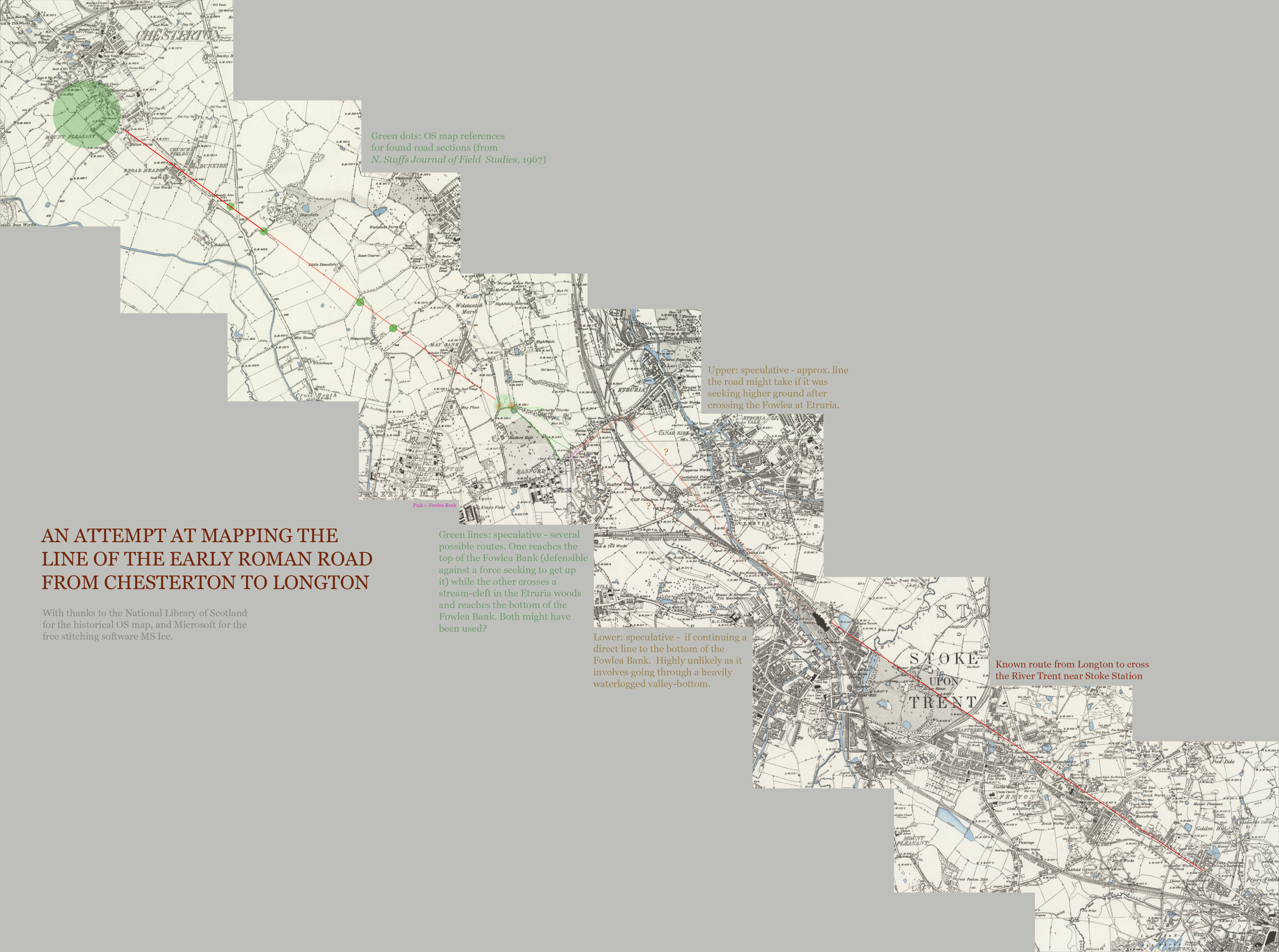
Having obtained the various OS map coordinates from the North Staffordshire Journal of Field Studies (1967), I can now plot more precisely the line(s) of the ancient Roman Road that ran from Chesterton – Stoke – Longton. The map used is public-domain OS and pre mass-housebuilding.

Updated: fixed dumb WordPress blogging software, which had scaled down the large image automatically. Now links to the full large version!