Update, 23rd February 2023: The path is now open at the southern end.
Since spring is just about to start I wondered if the ‘new river’ path along the River Trent was now ready, down in Stoke town. You’ll recall that the whole of the Trent was re-routed at Boothen (site of the former Stoke F.C. ground) and a massive new river channel was constructed. So… I took a look.
The answer is: not quite yet, but it looks like it could be relatively soon (April??). Actually, you can walk along most of the new path. But you can’t then connect with the old river path at the end of the new path. That end is currently blocked, as I show below.
So at February 2023, here’s a step-by-step guide to how to access the Trent path as a pedestrian, when starting on the Trent & Mersey canal.
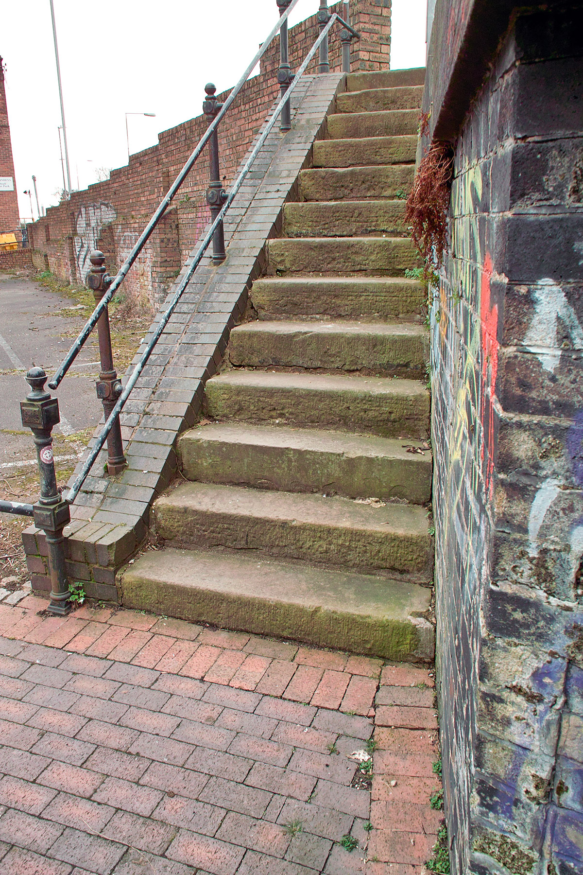
1. Come off the Trent and Mersey towpath at the low arched bridge at the Council House car-park at Stoke town (Stoke-upon-Trent). Go up these steps.

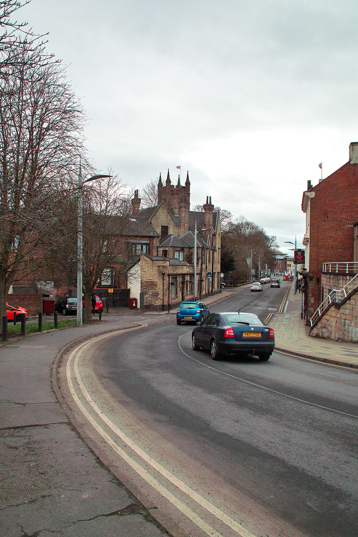
2. From the top of these steps you briefly cross the Council car-park entrance (“Wharf Place”, on maps) and go over the short but big bridge that crosses the A500 dual carriage-way road. This is too horrid to photograph but is very short, only 50 yards or so.
3. Once across the bridge, take the short curving pedestrian path down to the Minster (church).

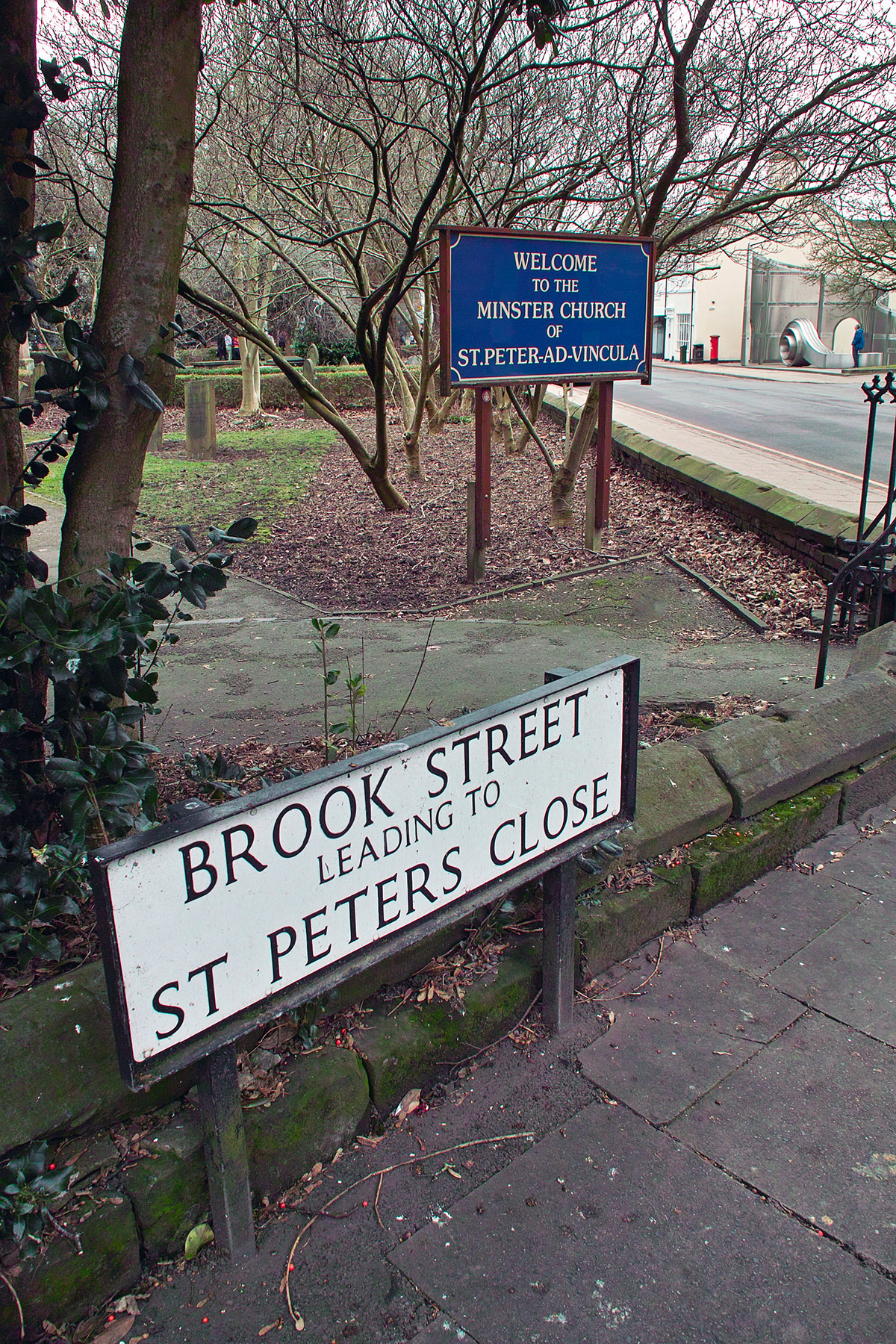
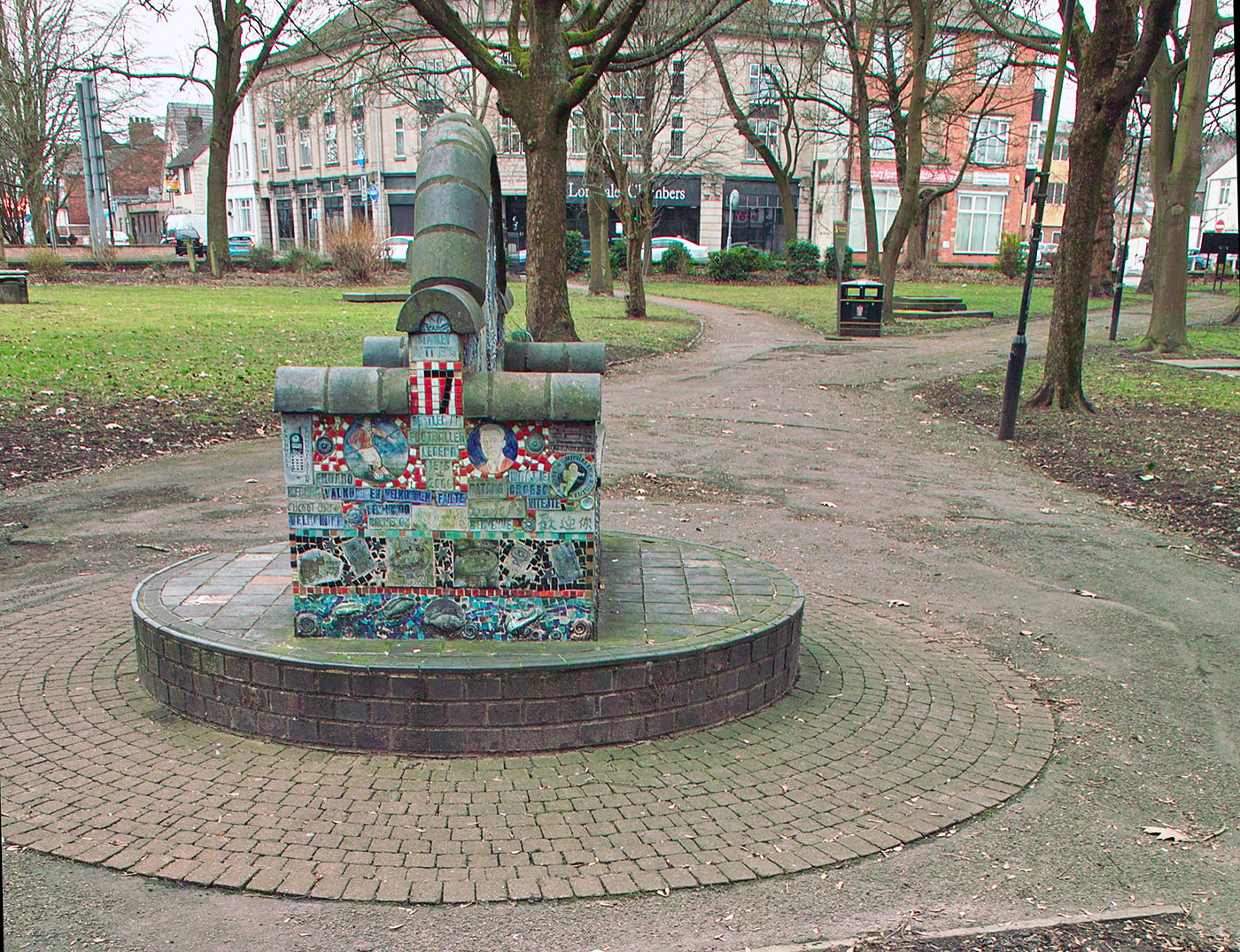
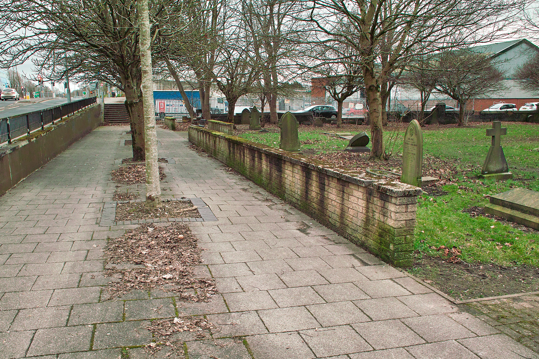
4. At the bottom of the curve, you will find yourself at the corner of the Minster churchyard at Brook Street. Enter the churchyard, and then go across it under the large mature trees.

While at the church doors, peep through the trees on your right and across the road… to see Stoke’s new £10m townscape heritage fund at work. They’re renovating a row of shops that had been grotty eyesores for decades. There is also an ancient Anglo-Saxon cross and other Saxon stonework in churchyard, if you care to find it.
5. Take the path in the picture that curves away to the left. On exiting the churchyard, nip across the Church Lane bus-lane via its handy traffic islands. (Less nimble folk should instead use the right-hand path, and use the pedestrian crossing).
6. You will now be on the other side of the road and thus alongside the ‘other half’ of the churchyard. Go left along the side of this and toward the steps you can see in the distance. They’re about where the river-path starts, at its northern Stoke end.
As an alternative, you might try the short and quiet Bowhead Street (side of the cemetery extension, where the parked cars are in the above picture), then turn left into the quiet Woodhouse Street. This option has the advantage of avoiding the steps and a close encounter with all the idling traffic fumes at the mega-junction.
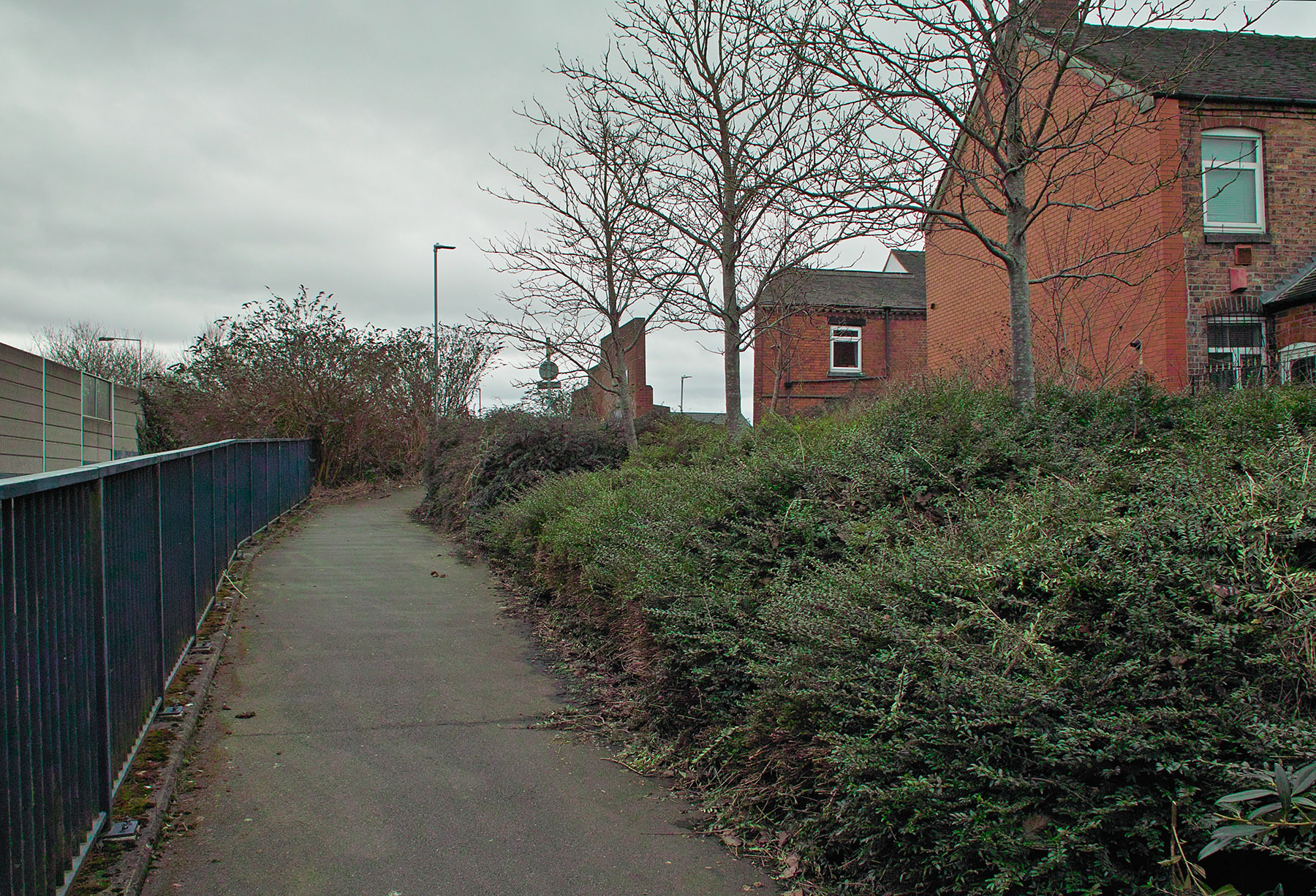
7. Either way, you’ll find yourself on the start of the first (most northerly) section of the paved River Trent path at Stoke. It’s a bit grotty, especially at the “dossers’ bench”, but it does the job. Follow this paved path along for a few winds and turns, until it ends here in a rise…

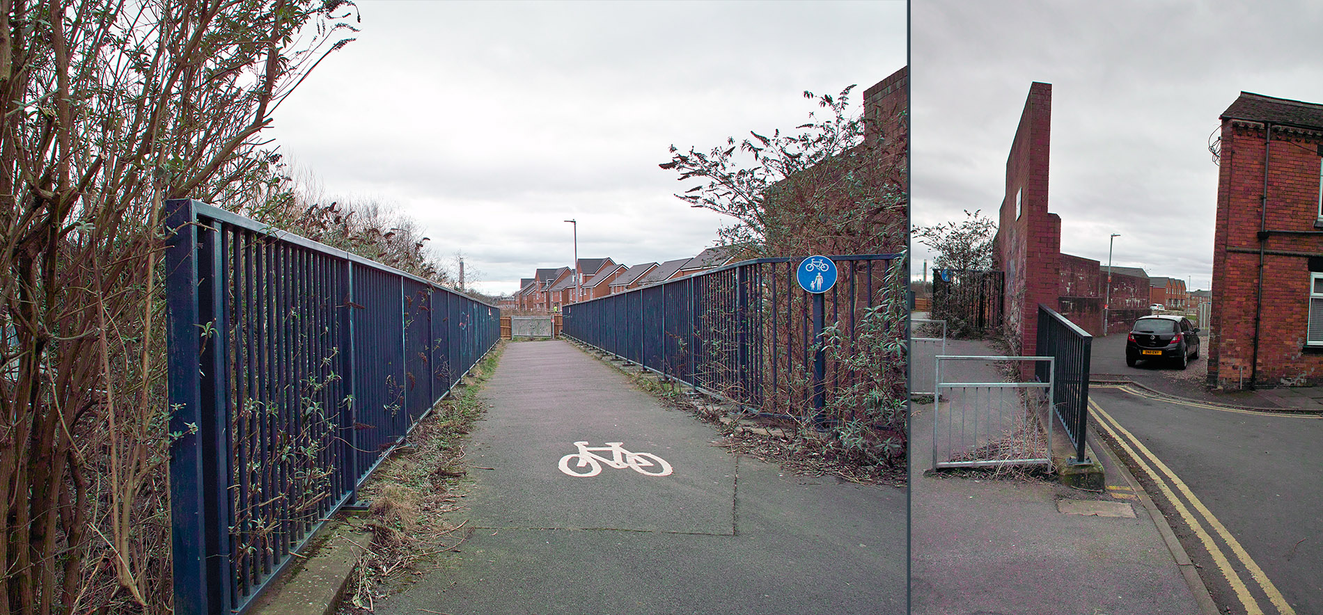
… and at the top of this rise you are then enticed to go across a pedestrian bridge by a cunning ‘cycles and pedestrians’ sign.

Once upon a time that worked to get you to the river, but no longer. Today it will only get you onto the Whieldon Road and on the way to Fenton, or over onto the canal with a bit of a wiggle.
So, instead, in 2023 you now go down the side of the bridge, as seen above in the picture on the right.
8. Yes, it looks like it might be someone’s parking-space. But go a few yards further on and you will have found the start of the new river-side path along the ‘new’ River Trent!
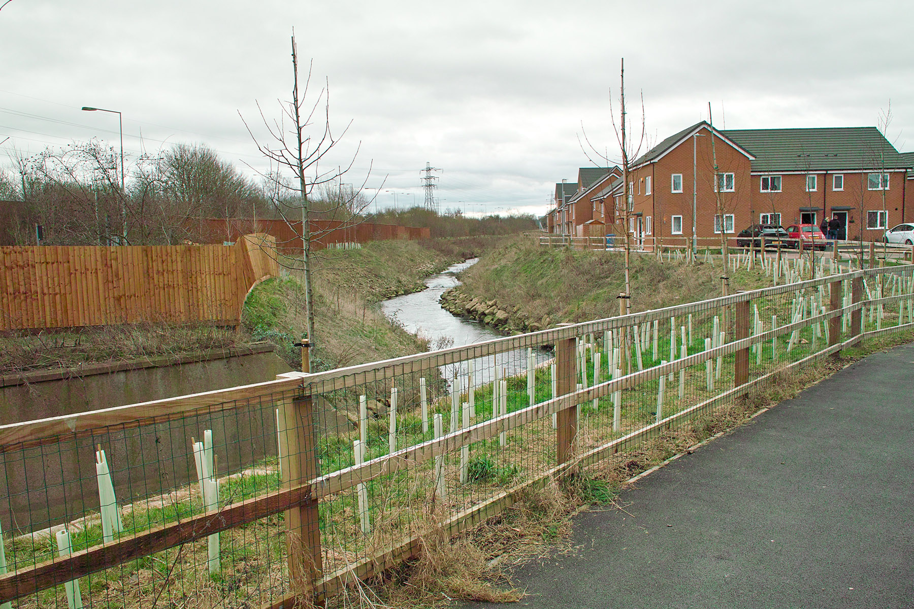
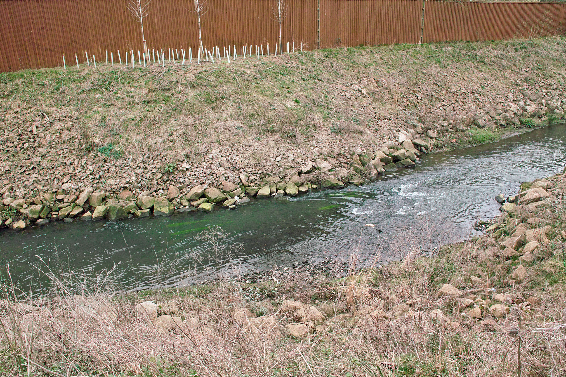
For now, before the trees grow and the vegetation takes over, you can look over the wooden fencing and admire the new nature-friendly banking and pebbling. So far, there’s not much rubbish being chucked over. But, as we all know, it only takes one feckless family and a few flytippers to ruin it for everyone else. Enjoy it while it’s rubbish-free.
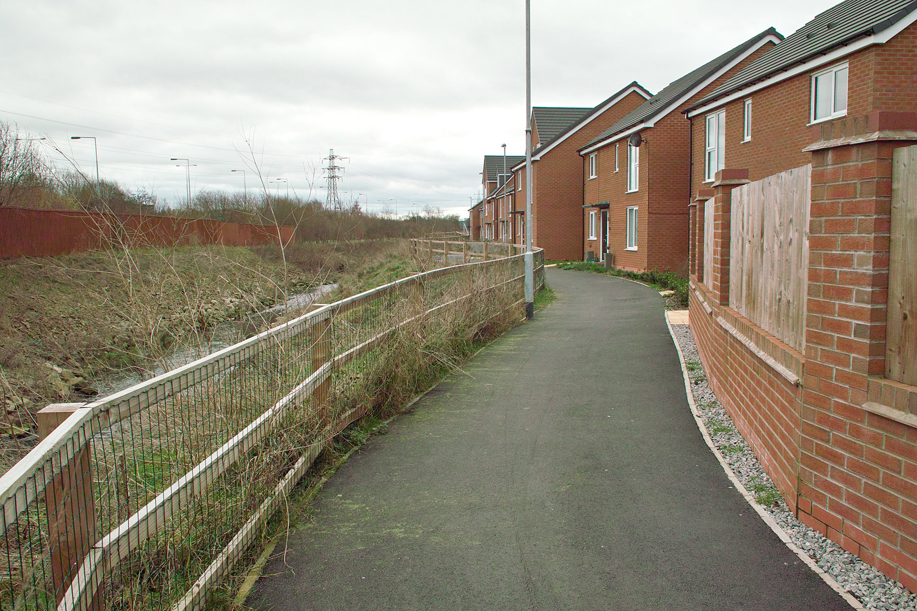
9. Go all the way along this new footpath…

Now on a bike in summer, you’d have to be very careful. The houses are rammed against the path and they have tiny front gardens. With many young families and hundreds of blind corners for small kids and dogs to pop out of, there’s no way you’d be able to safely race along this path on a bike at 25 mph. Boy-racers beware.
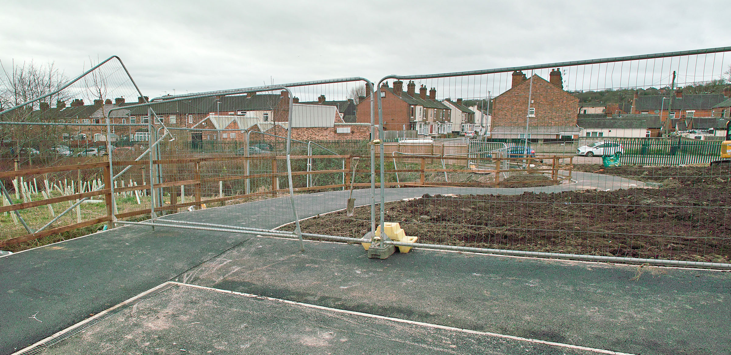
Ok, so after a while you get near the end of the path… only to find it’s blocked and not finished yet (February 2023).
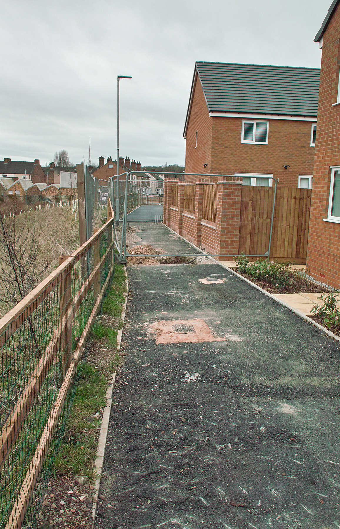
10. You might try to hook around through the estate, hoping for a bypass for this short blockage, and… still no access. The end point of the path is also not finished yet. Looks like it could be another six weeks work yet, especially if they first need to finish the “phase two” of the estate that’s currently going in alongside the path’s ending point.
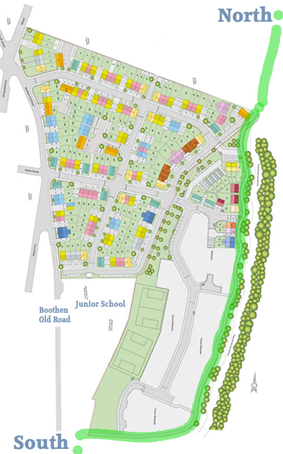
11. That’s Boothen Old Road you can see on the other side, a little south of the junior school. The entrance to the old established riverside path is a few yards further down on the left. Judging by the estate map seen below, it could well be a ‘nature bit’ at the southern end of the junior school’s new playing fields.
Here’s a half-built estate map showing how it should run. The path is in green.

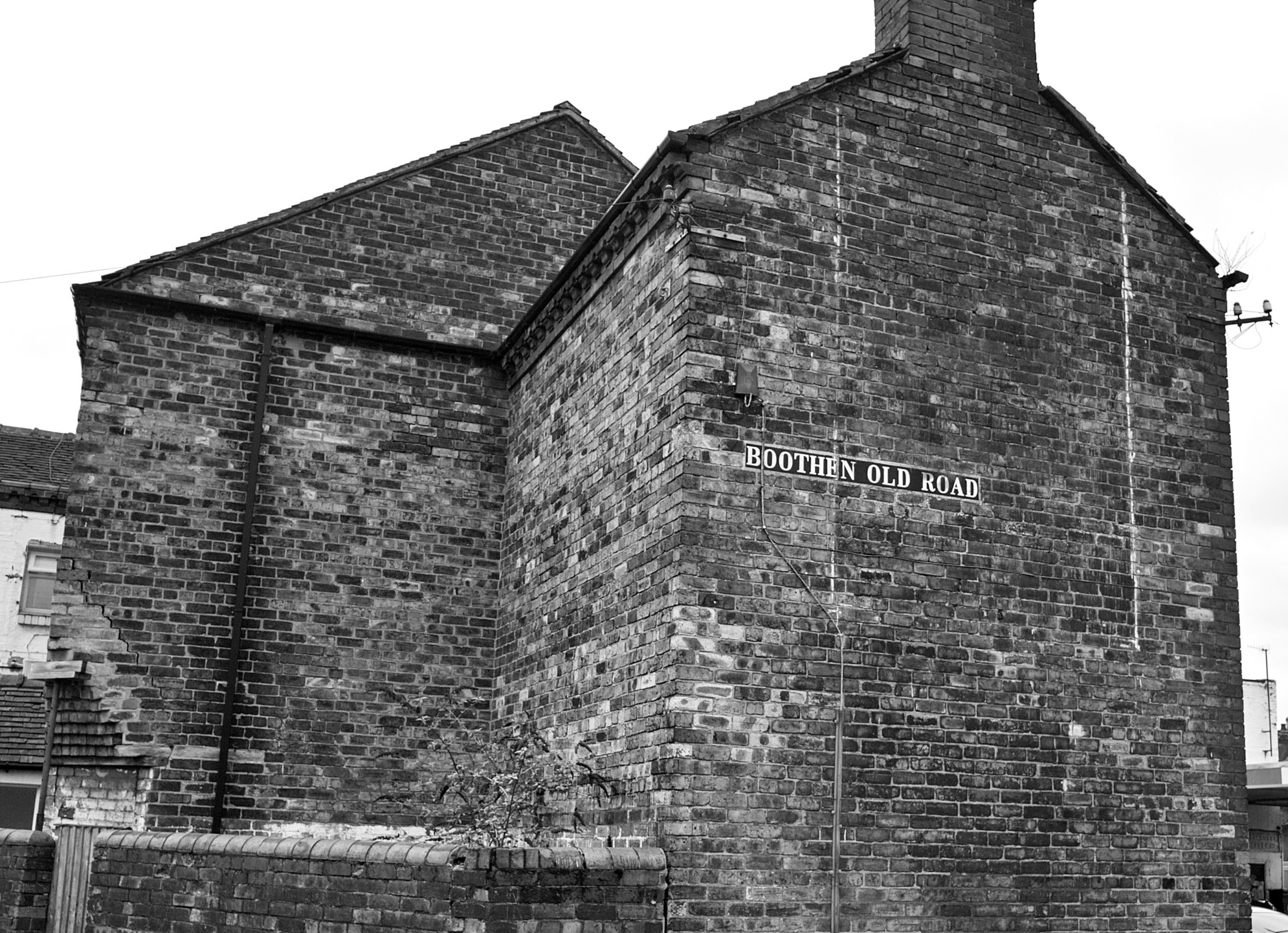
Good old Boothen Old Road, hurrah!
Due to the above blockage, for now you would instead need to go as far as Step 8 in the list above. But then you would:
9. Go a little way along the new riverside path, but then cut into the estate along Paul Ware Street, to reach the northern end of the Boothen Old Road.
(Bob McGrory Street may also be available through the estate, and a bit shorter. But possibly it would be easier to miss the turning of the path).
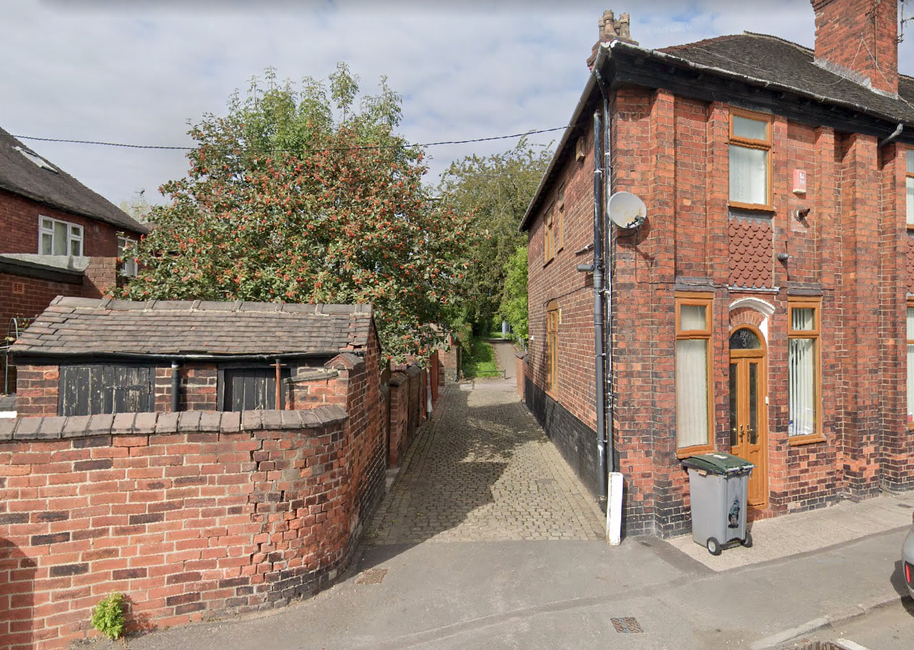
10. Now you’re on the start of the Boothen Old Road. You don’t want to go up that very tempting but very long cobbled alley on the right. Instead, keep on the gently curving road that goes down toward the junior school.
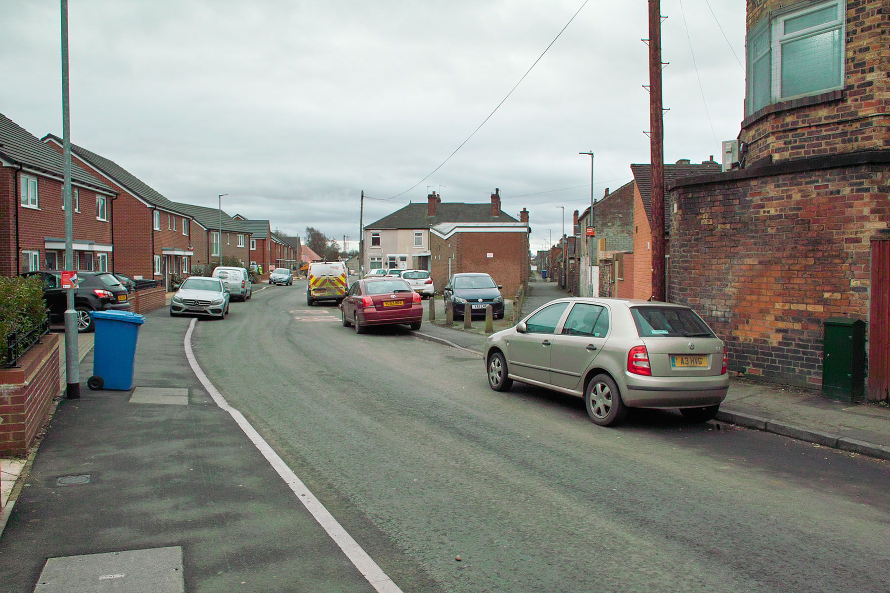
The obvious ‘bad parking and big bins’ problem means it can be a bit tricky to navigate the footpath down Boothen Old Road, but it’s not too bad.
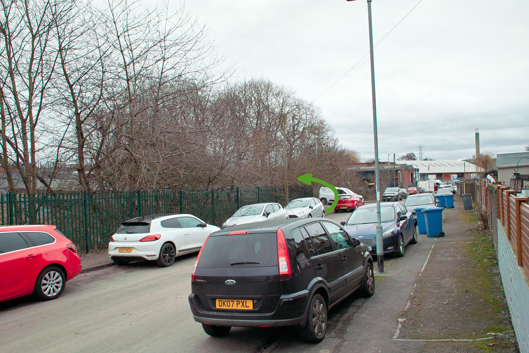
11. Go a short distance past the School, and you will see the (currently) blocked-off end of the new path. That is where you would have come out, and will do once the new riverside path is open. As you can see from the picture below, you may now think you’re headed into some industrial estate cul-de-sac. But the entrance to the old river path is hidden from view on the left. My green arrow shows where it is.
12. Ok, so by either route, you will now be standing at the entrance gate which will take you onto the longer-established river-path. You may still be unsure however, as it looks like you’re heading into a big dangerous electricity compound.
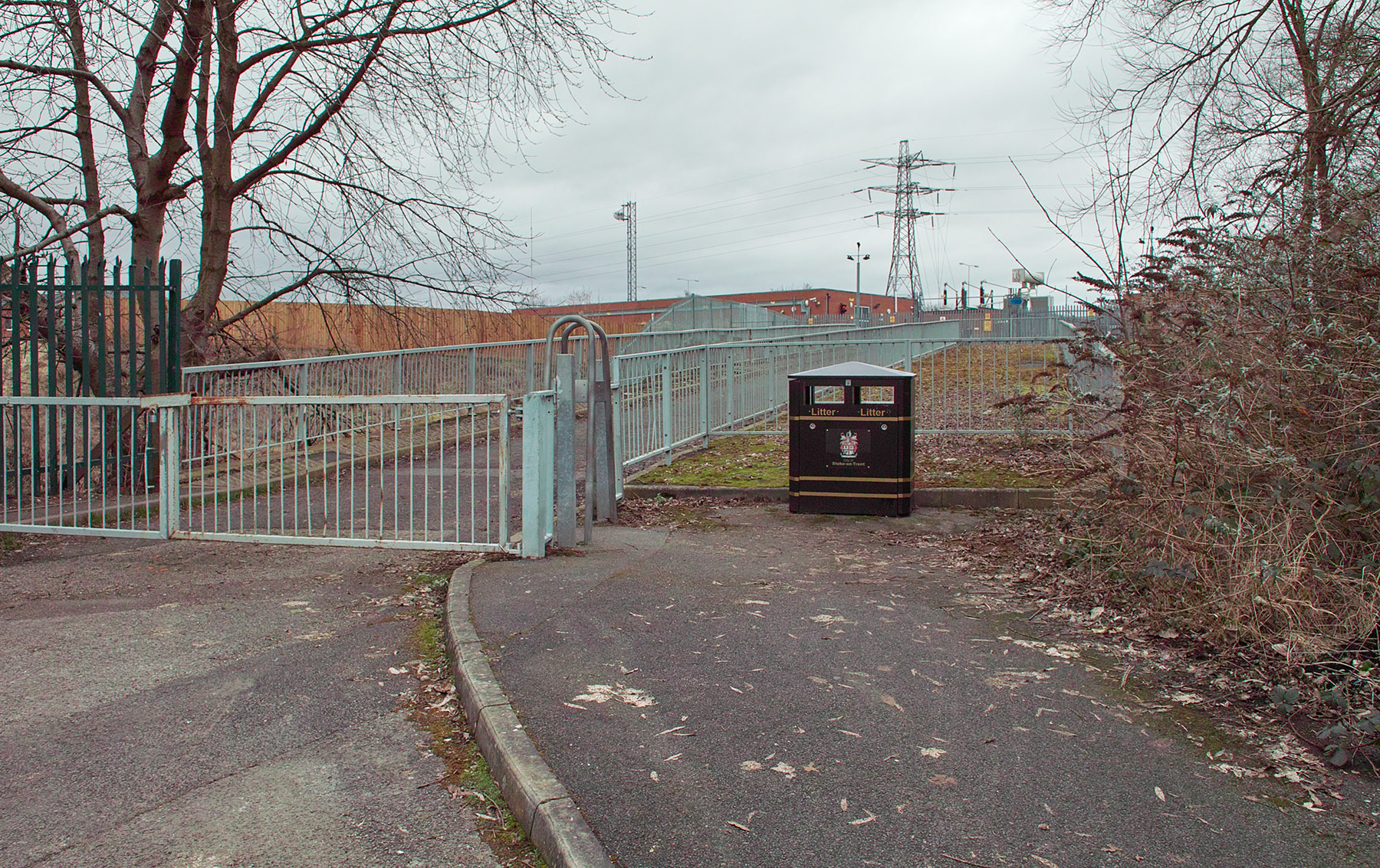
13. Have no fear though, no Thor-like electrical bolts will zap you if you step though. Go through the bike-gate and onto the bridge and you’ll see you’re on the right track. The river is below you.
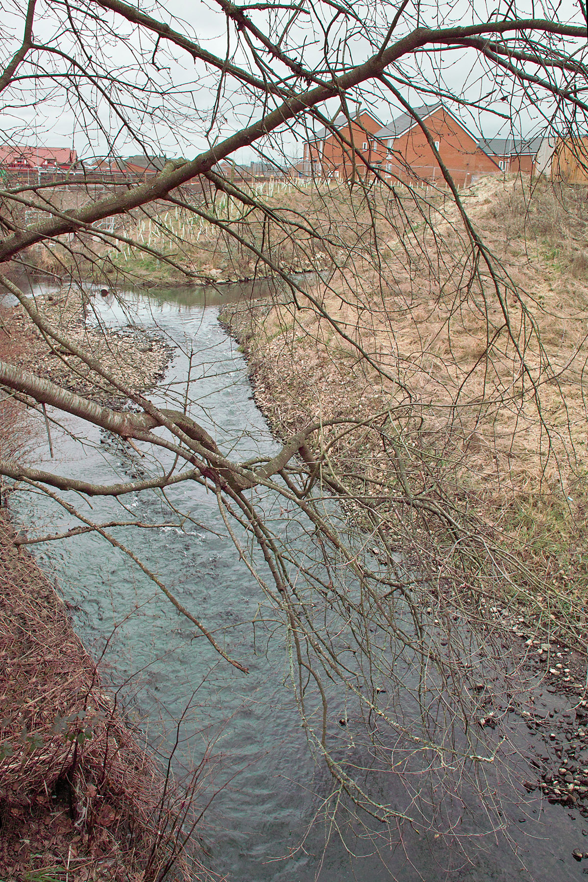
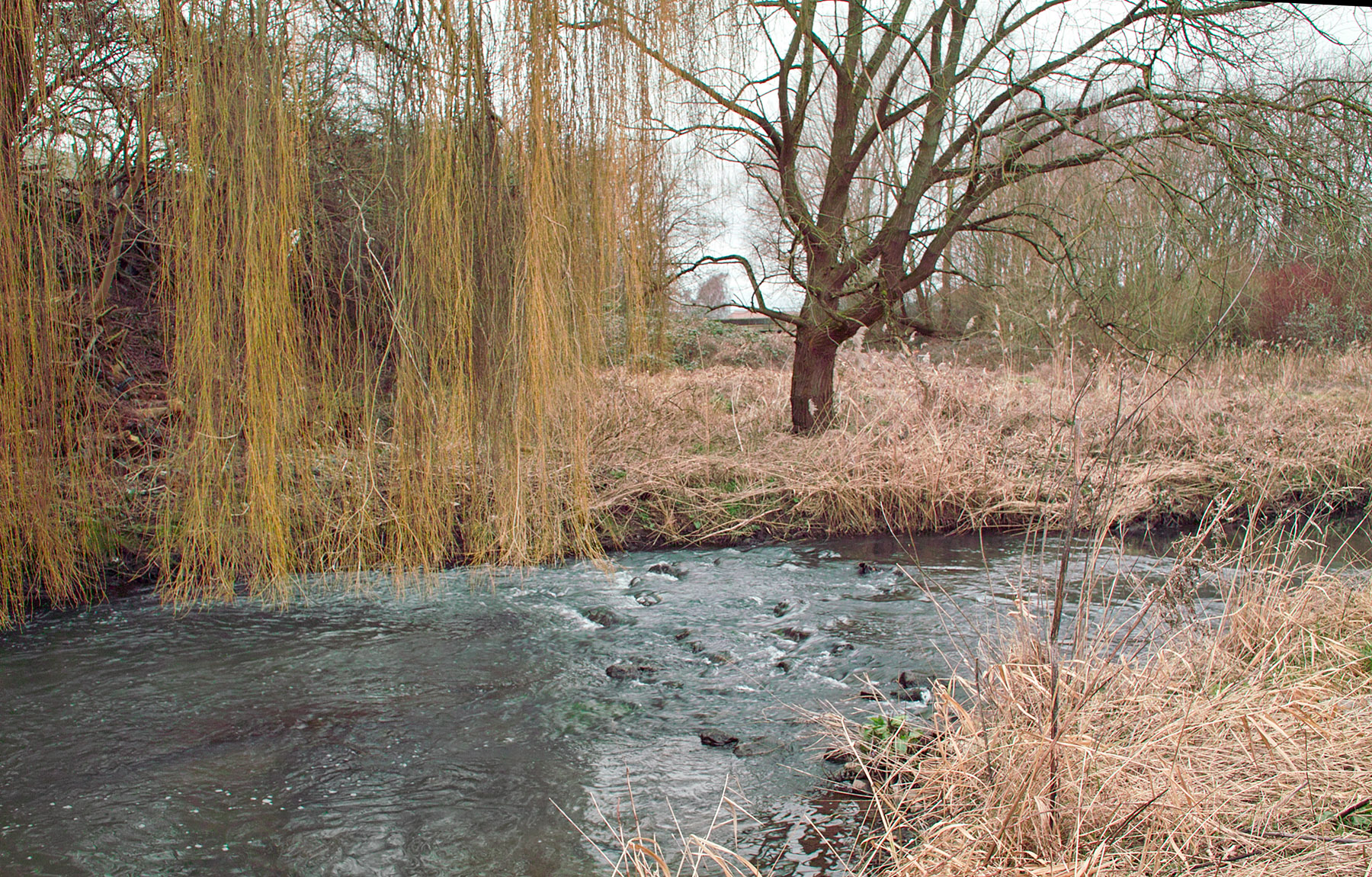
Again, you can see how the new river channel has been banked and shingled. Most of this view will soon be covered in leaves and greenery.
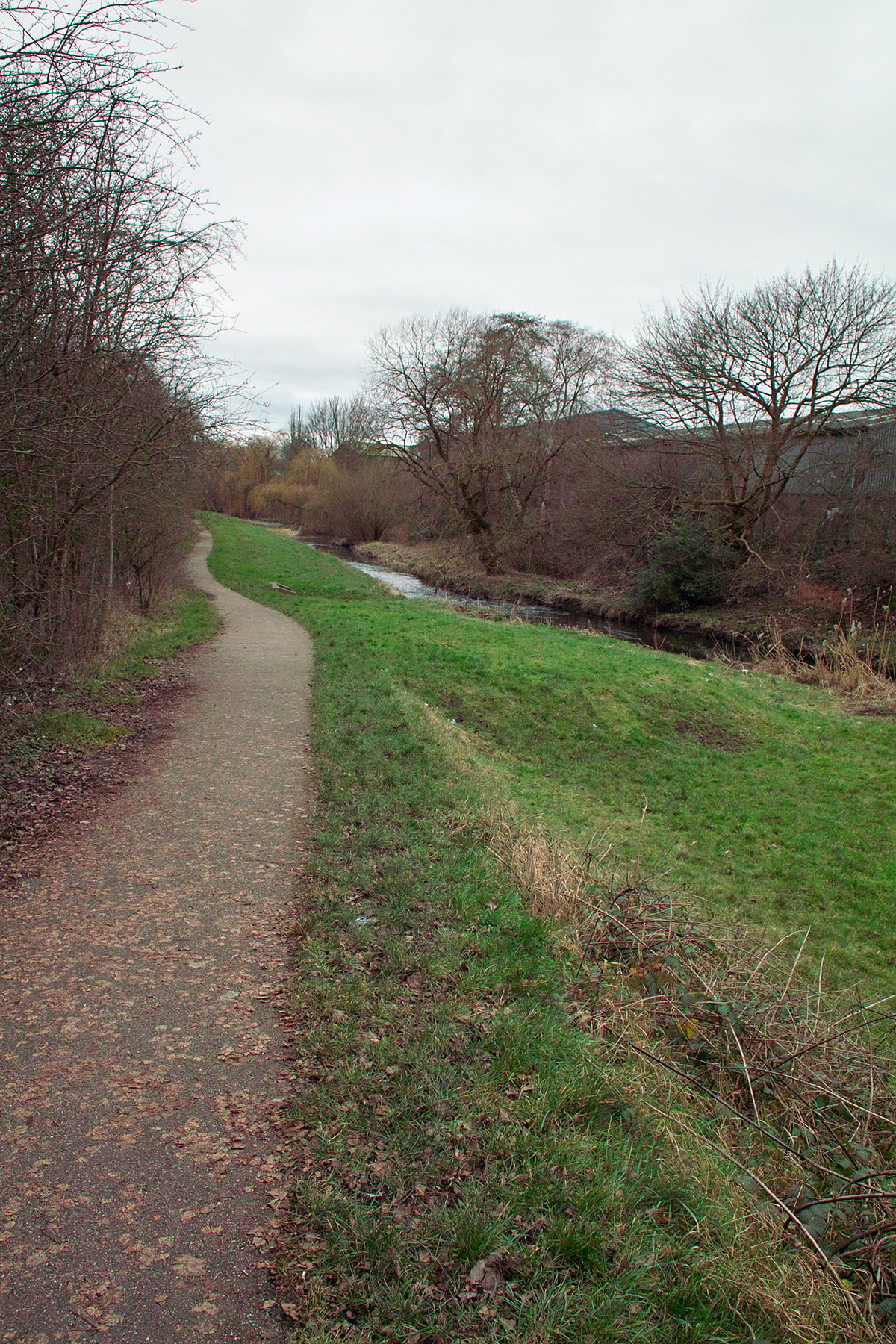
14. Finally follow the very grotty and litter strewn bit of the path, as it goes around the electricity compound. Druggies have obviously camped in the trees here. Hopefully the entire path from the Minster Churchyard to Hanford will get a very thorough litter-picking (and new signage) to celebrate the opening of the complete new path. But the path gets better after 50 yards, and eventually you see the paved path that runs down to rejoin the river. From here the nice and straightforward 1½ mile path will take you all the way to Hanford along the riverside (for an onward walk to Trentham Gardens and the Trentham Estate). The only problem you might have here is a bit of shallow flooding (only a few inches) of the path in the winter or early spring, after heavy rains. But that problem was caused by the river rising, and my guess is that the new upstream channelling and re-shaping will prevent this in future.
That’s it. Admire the many tree-ish views as you walk along the young River Trent!