Another local author found. The vales of Wever, a loco-descriptive poem (1797) by John Gisborne. Very much in the tradition of Erasmus Darwin, it describes and footnotes walks around Wootton, Norbury, and the Weaver Hills, local moors, and other places. He seems to have spent a year there and wrote this long poem in the ‘long-s’ style as a thank-you for his host. After his death his daughter published a short account of his life with diary extracts, of which there’s a poor scan at Archive.org.
Monthly Archives: June 2018
Where’s the path?
Where’s the path? is a UK map service. It usefully offers dynamically-recalculated O.S. grid references, in response to the movement of a mount-pointer over O.S. maps, and places the O.S. map side-by-side with satellite photography.
Lenovo Mirage Solo
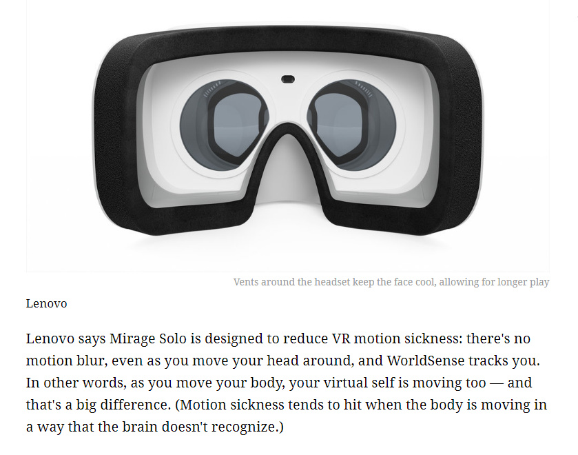
There are interesting moves afoot in VR tech which may be interesting for local history researchers no longer able to go tromping ten miles up and down hills, or who can’t afford to travel, but who still want to ‘visit’ places. Lenovo Mirage Solo is a new $399 VR headset which interfaces with Google’s Daydream apps inc. a version of Google StreetView, and has been specially designed to “reduce VR motion sickness”. According to the motion-sickness prone reviewer, that’s true, at least for a 12 minute immersion.
Sadly UK over-pricing is in play, and Lenovo has them at £499 on Amazon UK. When a straight currency conversion of $399 means they should be £299.
Before you plonk down your money, though, note that PCMag has a much more critical Lenovo Mirage Solo review, which reveals a critical shortcoming…
“Google Street View VR is a disappointment. I expected a free-exploring experience that would let me navigate around streets photographed by Google’s Street View cars, seeing 360-degree shots of hundreds of streets in different cities. Instead, it offers a selection of 360-degree panoramas based on the location you enter, and that’s about it. you don’t get the full Google Street View experience in first person, like you do when you open up Google Maps on your computer and just wander around Street View.”
Still, it looks like we’re starting to see interesting steps forward in fixing the motion sickness problem while interfacing with StreetView. Give it another few years, and by 2020 we have have full-version StreetView at £399, without motion sickness.
So it looks like I’ll be sticking with the free Google Earth Pro for a few years yet, without the VR goggles. A copy of 64-bit Earth Pro running on Windows is a much better experience on a desktop than having to wrestle with Google Maps in a Web browser.
New book: Clash of Cultures?: The Romano-British Period in the West Midlands
I see that Volume 3 of The Making of the West Midlands series was published at the end of April: Clash of Cultures?: The Romano-British Period in the West Midlands.
Surveys the archaeology (inc. posing the question “two regions?”); the fortresses and forts; then Warwickshire, Worcestershire, Herefordshire, Shropshire, Staffordshire (cropmark evidence “excluded from this volume”, it notes there). There’s also a landscape-use chapter, one on distribution of coin-finds with some heavy maths, and one that tries to join up all the ceramics evidence. The chapter on religious sites focuses on Wroxter, Coleshill, Rocester and Wall. Finally, and possibly most interestingly, “The West Midlands in the fifth and sixth centuries”, but that’s completely unavailable as a preview.
Interesting to see how everything funnelled toward Penkridge…
… and yet there’s been hardly any investigation of the site, and thus the book can only give it a short paragraph that speculates it may have been strung out along the Watling Street.
Newly public PhD: North Staffordshire Potteries, 1750-1851
New PhD. Networks, innovation and knowledge: the North Staffordshire Potteries, 1750-1851 (2017), now online and public. It…
“reconstructs the district at the firm level, showing that the region’s growth was incredibly dynamic. The spatial concentration of producers and the importance of social and business networks are also explored through a new map of the region in 1802 and social network analysis. … a study of a craft-based, highly skilled industry without a legacy of formal institutions such as guilds to govern and protect access to knowledge”


